The town of Harpers Ferry is a national park located (now) in the state of West Virginia, but it also borders the states of Maryland and Virginia. The town once had an armory (established by George Washington to build muskets), a cotton mill among other important manufacturing sites, and a college. It is also the site of the 1862 Civil War Battle of Harpers Ferry, when the town was in the state of Virginia.
Here visitors can hike a section of the Appalachian Trail, walk the C & O Canal towpath (part of the Appalachian Trail), or enjoy several other hiking trails. There are also outfitters nearby that can put you on a river if water sports are your thing. Several museums and other points of interest are located along Potomac and High Streets in the lower town.
The Appalachian Trail winds its way from Maryland Heights across the Potomac River and through Harpers Ferry
Peaceful path to Virginius Island
The Rivers
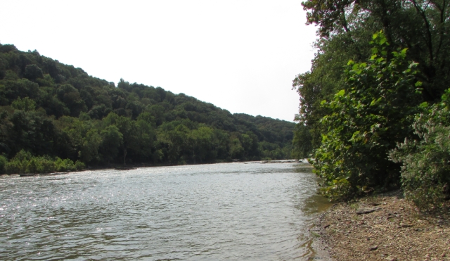
The Point is where two rivers converge. This is a popular place in the park. It is interesting to see the water of the Potomac blend with the water of the Shenandoah where they meet at the center of the image.
The forest green water of the Potomac (foreground) flows into the olive green Shenandoah (background)
Along the bank of the Shenandoah
The Town
When visiting Harpers Ferry, guests can park at the visitor center then board a free shuttle to take them to the lower town. A hiking trail leads to the lower town for those who would rather walk. There are many historic buildings to see and there are also shops and restaurants. Although it is a national park, Harpers Ferry does have residents.
High Street
Along Shenandoah Street
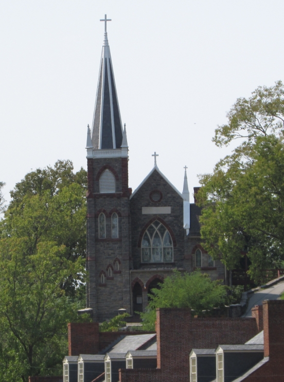
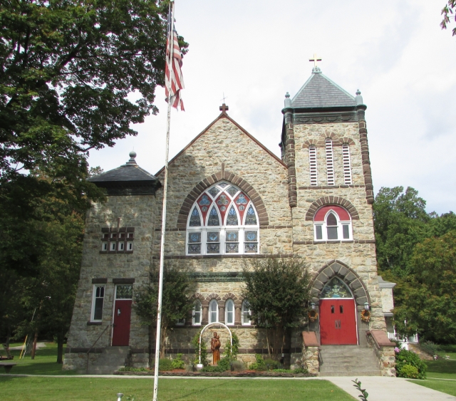
Saint Peter’s Roman Catholic Church
John Brown
John Brown was a staunch abolitionist. In 1859, he organized a raid on Harpers Ferry. The rebellion, which was intended to arm enslaved men by seizing the armory, was a failure. After a thirty-six hour standoff, Brown and his men were killed or captured by a group of US Marines led by Robert E. Lee. Brown was later found guilty of treason, inciting a riot, and conspiracy. His trial and subsequent hanging took place in Charles Town, Virginia, now West Virginia.
John Brown’s Fort was originally the firehouse for the armory in Harpers Ferry. It is now referred to as John Brown’s Fort because it is where he and his men barricaded themselves during the final hours of their raid before being captured.
This and the photo above were taken at the National Civil War Museum in Harrisburg, Pennsylvania
It is reported that Brown wrote this on the wall of his cell just before being hanged: “I, John Brown, am now quite certain that the crimes of this guilty land will never be purged away but with blood.”
Miscellany
The Harpers Ferry train tunnel is actually on the Maryland side of the Potomac River
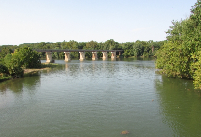
Remains of a B & O Railroad bridge which spanned the Potomac River at Harpers Ferry. While these piers are newer, railroad bridges here were destroyed and rebuilt nine times during the Civil War, however, five of those times the bridges were destroyed by floods.
Shenandoah Bridge near The Point at Harpers Ferry. The bridge was originally constructed in 1882. It was destroyed by a flood in 1889 and rebuilt. These piers are all that remain after another major flood destroyed the bridge in 1936.
Ruins along Virginius Island Trail
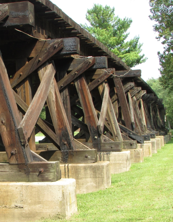
Train trestle currently used by Amtrak and a commuter train service
We’re going to wrap up our visit to Harpers Ferry here. Thanks so much for joining us on the road. We hope you will come back again to enjoy more of our Mid-Atlantic road trip. Until next time…
Travel safe, travel smart, and we will see you down the road.
Mike and Kellye
As always, we strive to be as accurate with our information as possible. If we made a mistake, it was unintentional. (Hey, we’re only human!) We aren’t paid for our recommendations, and we only recommend our own tried and true vendors and venues. Our suggestions are for places that we’ve heard good things about but haven’t visited personally, and our opinions are our own.
The C & O Canal runs for 184.5 miles from Washington, DC to Cumberland, MD
The first idea for a canal was introduced as a bill submitted in 1774 to the Virginia governing body of the time by George Washington. His plan was to use the Potomac River as a means to move cargo, however, there were parts of the river that would be too dangerous for boats. He proposed to build a canal system that would enable navigation around those treacherous areas. After the Revolutionary War, his plans were set in motion and the Potowmack Canal Company was established with Washington at its helm. The canal was completed in 1802, three years after Washington’s death. It operated until 1828 when the Chesapeake and Ohio Canal Company took over Potowmack Canal Company and devised a plan to build a better canal system which would connect the Ohio River to the Chesapeake Bay. Under the new C & O plan, the canal would run next to the Potomac, but boats would not have to navigate the river. The construction period ran from 1828 to 1850, but the canal never made it to the Ohio River, mainly because the Baltimore and Ohio Railroad got there first. Moving cargo via the railroad was faster and more efficient. The canal was utilized from 1831 to 1924, and in its last years was used primarily for moving coal from the Allegheny Mountains to Washington, DC.
In 1938, the government purchased the canal with plans to turn it into a recreational area. President Eisenhower declared a portion of the canal a national monument in 1961. Ten years later, President Nixon signed a bill into law creating the Chesapeake and Ohio Canal National Historic Park.
Cushwa’s historic warehouse in Williamsport, MD, one of the three current visitor centers for the park
We chose to visit the Williamsport, MD portion of the park because it was the closest to our next destination. Our initial plans did not include this stop, but we are so glad we were able make the last minute change. Williamsport is the future home of the park’s headquarters. The National Park Service is currently refurbishing the site of a former lumber company that sits across the street from Cushwa’s.
This portion of the park sits at the confluence of the Potomac River (background) and Conococheague Creek (foreground). What a serene and beautiful place we found this to be on a lazy September morning. By the way, those trees on in the background are in West Virginia. Here the Potomac forms the border between West Virginia and Maryland.
The canal as it flows over the recently restored (in 2019) Conococheague Aqueduct
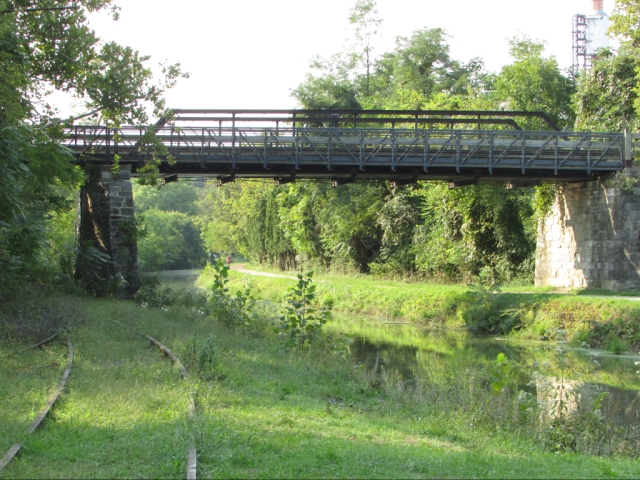
The 1879 Bollman bridge over the canal is one of the oldest standing iron railroad bridges in the US. Here you can see the towpath where mules would walk as they towed boats up and down the canal. Now, the towpath is used for a walking and biking trail. Trivia: the C & O Canal towpath at Harper’s Ferry, WV is part of the Appalachian Trail.
Wendell Bollman, a self-taught engineer who began his career at the age of 15, designed a specific type of truss, now called the Bollman Truss, that was used for many bridges built by the Baltimore and Ohio Railroad (B & O) including the one shown above. Trivia: the B & O Railroad is the same one that sits between Illinois and Atlantic Avenues as depicted on the classic Monopoly game board.
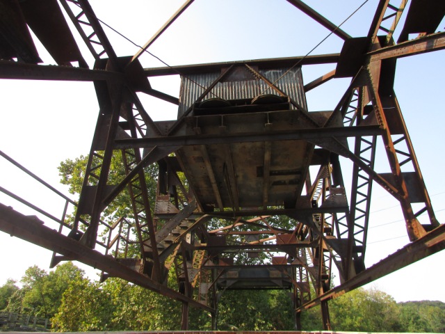
Built in 1923, this strange-looking contraption is the only one of it’s kind on the C & O Canal. It is a railroad lift bridge that operated like an elevator to lower the tracks enabling trains loaded with coal to cross the canal. It is now a pedestrian bridge.
A view of the railroad lift bridge from underneath
A different view of the Bollman bridge with railroad tracks on the ground next to the canal. These tracks (along with the railroad lift bridge seen in the previous photos) would have been for the trains delivering coal to the power plant, part of which can be seen in the top right-hand corner of the picture.
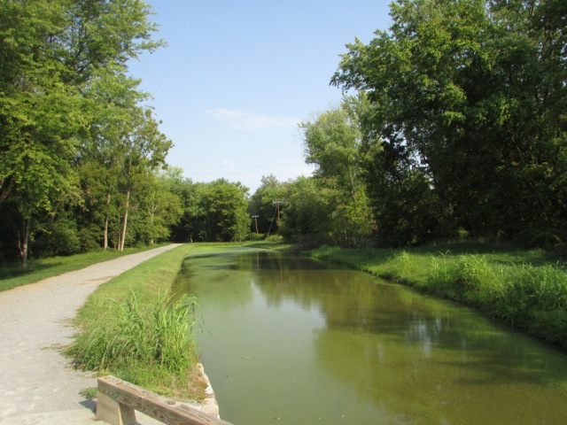
We are going to end our trip to the Chesapeake and Ohio Canal National Historical Park here, but we will leave you with one more look at the canal and towpath. Imagine warm sunshine, no breeze, the smells of the earth, and complete solitude with nothing to disturb you except the summery drone of an occasional cicada. This is that place.
Thank you so much for stopping by our blog! Please come back soon for another road trip, quick stop, or travel tip. We love hearing from our readers, so feel free to leave a comment, and be sure to “like” us, too. Become a follower so you never miss one of our posts. We will not share or sell your information
Until next time…
Travel safe, travel smart, and we will see you down the road!
Mike and Kellye
As always, we strive to be as accurate with our information as possible. If we made a mistake, it was unintentional. (Hey, we’re only human!) We aren’t paid for our recommendations, and we only recommend our own tried and true vendors and venues. Our suggestions are for places that we’ve heard good things about but haven’t visited personally, and our opinions are our own.
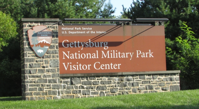
Gettysburg has a lot to see and do, and honestly we should have stayed for more than a day. We spent two hours viewing the introductory film, seeing the cyclorama, and seeing the museum. All three are covered in a $15.00 fee at the visitor center. Otherwise, the park is free to visit. The auto tour took another three hours. We hiked one trail near Little Round Top and then walked the entire National Cemetery Trail. In all, we probably spent six to seven hours in the park. If you have never been to Gettysburg, you need to know that the park is surrounded by the town where traffic is heavy and parking is almost non-existent. Downtown Gettysburg is fun and has lots of shops and restaurants, but be prepared to feed a parking meter if you go.
Restaurant recommendations:
Tommy’s Pizza – great for lunch.
The Gettysburger was worth the hour-long wait for a table for dinner. The food was great and the service was excellent. They even have a dog menu if you want to have your fur baby join you on their patio! We highly recommend making a reservation.
The Auto Tour
The auto tour is 24 miles long and can be self-guided or many types of guided tours are available. We chose to do the self guided tour which is easy using the information provided in the park brochure. The tour is well marked with signs so it is easy to follow. We did not stop at every memorial or monument, however, we did stop at all sixteen points of interest described in the brochure.
Eternal Light Peace Memorial – “Peace Eternal in a Nation United”
The Virginia Memorial
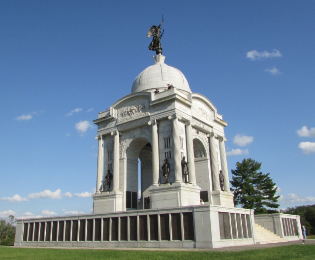
State of Pennsylvania Monument
Church at the Lutheran Theological Seminary – Seminary Ridge
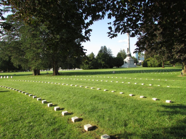
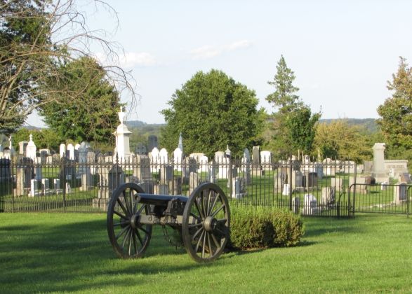
The Gettysburg National Cemetery
The National Cemetery is a a somber and extremely beautiful place. While driving through the battlefields, you can’t help but think about what took place there and the lives that were ended or changed forever on those hallowed grounds, but walking through the cemetery really brings it home.
The Soldiers National Memorial at Gettysburg National Cemetery sits on the site of President Lincoln’s Gettysburg Address
The Gettysburg Cyclorama
The Gettysburg Cyclorama, which is 377 feet long and 42 feet high, is a stunning depiction of the final Confederate assault on July 3, 1863. The painting, one of the largest in the world, was done by Paul Philippoteaux in the 1880s. The building that houses the cyclorama provides special lighting and sound effects that seemingly place the viewer in the midst of the battle. The narrator does an excellent job of pointing out the landmarks and explaining how the battle took place. Seeing this before we took the auto tour really helped us to know what we were looking at. Some of our photos are below, and here is a link to the National Park Service website which has the history of the cyclorama, videos, and additional photos:https://www.nps.gov/gett/planyourvisit/cyclorama.htm
This is a close-up of the photo above. Look closely at the man being carried. It’s a little Easter egg that Philippoteaux added to his masterpiece. Do you see that the man is Abraham Lincoln? They also said that Philippoteaux portrayed himself somewhere in the painting too, but we didn’t find him.
The Gettysburg Museum
So much to see and learn in this museum! It is a definite must-do prior to taking the auto tour. We were particularly interested in the many flags that are on display. Below are a couple of the exhibits.
We’re going to close this post with one last picture from the auto tour. Please come back often to see more of our latest trip. Better yet, become an e-mail follower so you will be notified every time we post. We will not sell to or share your information with anyone.
The beautiful State of Vermont Monument
Thanks so much for riding along with us. Until next time…
Travel safe, travel smart, and we will see you down the road!
Mike and Kellye
As always, we strive to be as accurate with our information as possible. If we made a mistake, it was unintentional. (Hey, we’re only human!) We aren’t paid for our recommendations, and we only recommend our own tried and true vendors and venues. Our suggestions are for places that we’ve heard good things about but haven’t visited personally, and our opinions are our own.
Covid threw us (and everyone else) for a loop, but after a too-long hiatus, a lot of research, and many hours of soul searching, we decided to mask up, pack our hand sanitizer, and get back to business. We are thrilled to share our 1200 mile, five state Mid-Atlantic road trip with you over the next weeks and months, so buckle up and enjoy the ride.
Our trip began and ended in Baltimore, MD because…well, Southwest flies there. We try to always fly Southwest if possible – gotta love those points! Plus, Baltimore was a perfect central location for everything we wanted to do and see. What we didn’t expect was the heavy traffic. (Wilmington and Baltimore, we’re looking at you!) For a couple of folks from the wide open spaces of West Texas, we weren’t used to taking two and a half hours to go 68 miles. That said, the trip was great and the bumper to bumper traffic in some areas just added to the adventure.
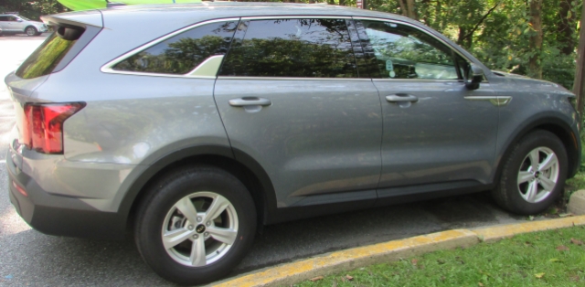
Here’s our cute Kia Sorrento rental car.
Catoctin Mountain Park (Thurmont, Maryland)
Our very first stop on the trip was at Catoctin Mountain Park in Maryland. It is a free entrance national park site that includes a scenic drive, hiking trails, campgrounds, picnic areas, streams, fishing, rock climbing, and cross country skiing in the winter, and it abuts Cunningham Falls State Park, which is the site of the highest waterfall in Maryland. You may not have heard of Catoctin Mountain Park, but we bet you’ve heard of Camp David. The presidential retreat established by Dwight D. Eisenhower and named after his grandson is located in Catoctin Mountain Park. Camp David is not accessible to the public and its location is apparently kept very secretive. We happened to see what we believed to be the entrance because it had official looking gates with signs that prohibited parking, standing, and picture taking.
Oh, the beauty, the delightful bird calls and the earthy smells of the forest. We love a good trail, and this one didn’t disappoint.
Pastoral Catoctin Mountains farm scene from the overlook at the end of the trail
Here’s a handy link to Catoctin Mountain Park for more information: Catoctin Mountain Park
National Shrine Grotto of Our Lady of Lourdes
We didn’t have this stop on our itinerary, but it was on the way to Gettysburg so we took a chance. What a great place to see! The National Shrine Grotto of Our Lady of Lourdes is on the campus of Mount Saint Mary’s University in Emmitsburg, Maryland. The grounds, walking paths, and gardens are beautiful. We got to witness a pilgrimage to the Grotto while we were there, which was an exciting first for us. That is why there are no pictures of the actual Grotto, but below are some shots from in and around the area. While viewing the pictures, imagine walking through a serene garden setting on a mountain top while a carillon rings out “How Great Thou Art”.
Chapel
Reflecting Pool
Beautiful Jesus
Saint Anthony Shrine (dedicated in 1859) near the National Shrine Grotto in Emmitsburg
Here is the link to The National Shrine Grotto if you would like additional information: Saint Anthony Shrine
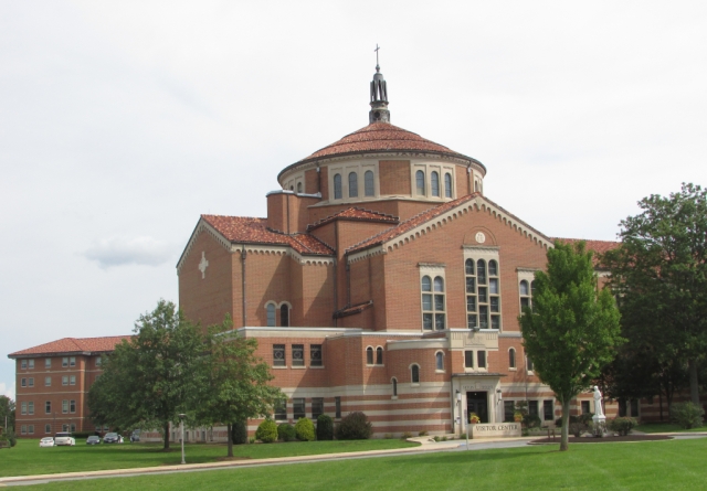
The National Shrine of Saint Elizabeth Ann Seton
Also in Emmitsburg, MD, is the National Shrine of Saint Elizabeth Ann Seton. Born in 1774, she was the first American to be canonized by the Roman Catholic Church.
Shrine and Basillica
Also of interest in Emmitsburg is the National Fallen Firefighters Memorial which is located just down the street from the Seton Shrine.
Here is the link to The National Shrine of Saint Elizabeth Ann Seton: Seton Shrine
Here is the link to the National Fallen Firefighters Memorial: Fallen Firefighters
That is all we have for this post. You won’t want to miss ournext exciting destination, Gettysburg. We appreciate you for visiting our site and riding along with us on our adventures. We would love to hear from you, so feel free to leave a comment. Until next time…
Travel safe, travel smart, and we will see you down the road.
Mike and Kellye
As always, we strive to be as accurate with our information as possible. If we made a mistake, it was unintentional. (Hey, we’re only human!) We aren’t paid for our recommendations, and we only recommend our own tried and true vendors and venues. Our suggestions are for places that we’ve heard good things about but haven’t visited personally, and our opinions are our own.
As we traveled through Maine, New Hampshire, and Vermont, we found beautiful plants and flowers at every turn. Most of the flora we encountered was trees, which are sparse in our part of West Texas, so we were enchanted by the sheer numbers of them. What was interesting to us was not only the countless trees, but the variety of trees we saw everywhere we went. Oh, and the flowers were spectacular! Now, because of so much “pretty”, we have created a post showcasing another part of the beauty of New England to share with you. We hope you enjoy…
Water lilies on a pond at Acadia
Beach roses
Some of the plants that we’re showcasing were growing wild and some were in gardens. We have been able to identify a lot of them, but some of them remain nameless. If any of you can tell us what the UFO’s (Unidentified Flowering Objects) are, please leave the answer in the comments section below.
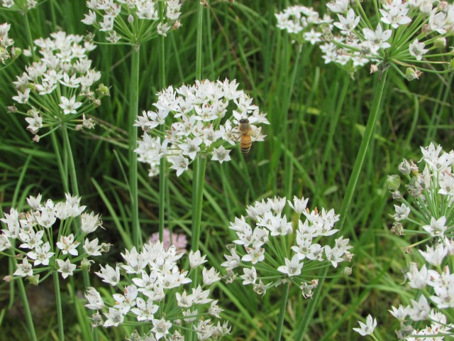
Can anyone identify this gorgeous plant?
We found ferns everywhere we looked
Mountain Ash. The clusters of lipstick red berries made them hard to miss.
Does anyone know what this pink plant is called?
This majestic tree is on the grounds of the Marsh-Billings-Rockefeller National Historic Park, near the visitor center.
Sunflower in a garden in New Hampshire
Viburnum
Pink Viburnum
Velvety mosses carpet the forest floor
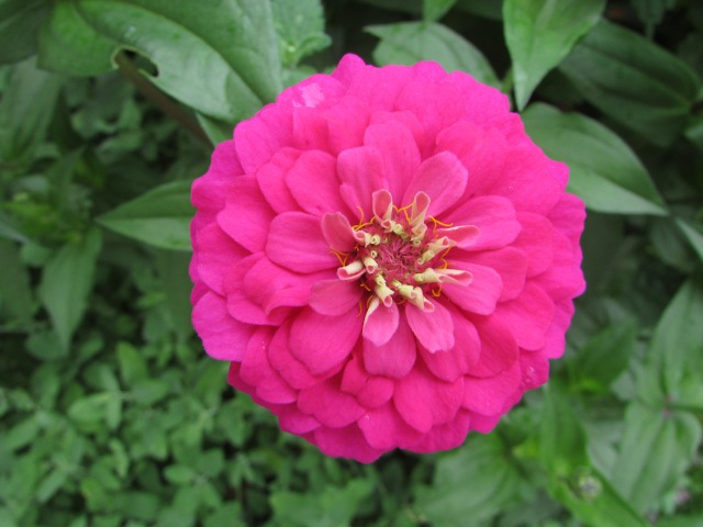
We had to include this hot pink zinnia that we found growing near the Vermont State House
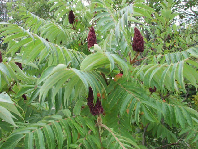
Staghorn Sumac
We aren’t sure what kind of tree this is (birch, maybe?), but we thought it was interesting.
Asters
We are tempted to call these sedum, but we’re not sure. Can someone confirm?
Stunning dahlias found in a garden in Bar Harbor
More dahlias. Breathtaking!
Okay, one more dahlia, and then we’re going to call this post finished. (It’s so beautiful we couldn’t leave it out!)
Thank you for letting us share the beauty of New England’s plants and flowers with you. We hope you enjoyed this excursion through the flora! Please come back to our site often for more pretty pictures, exciting road trip destinations, and lots of other great stuff. We really appreciate your “likes” and comments. If you are not a follower, become one so you never miss a post.
We are going to close this post with hydrangeas. We saw them everywhere we went, and they were exquisite. See for yourself…
We got caught by the homeowner when we were taking this photo, but his hydrangeas were way too pretty to pass up. When we told him what we were doing, he just smiled and waved. We have a feeling that we probably weren’t the first people to stop by this house for a picture.
These hydrangeas were in front of the New Hampshire State House.
Until the next trip…
Travel safe, travel smart, and we will see you down the road!
Mike and Kellye
As always, we strive to be as accurate with our information as possible. If we made a mistake, it was unintentional. (Hey, we’re only human!) We aren’t paid for our recommendations, and we only recommend our own tried and true vendors and venues. Our suggestions are for places that we’ve heard good things about but haven’t visited personally, and our opinions are our own.
Bored? Stuck at home? Rather be on the road or camping? We are right there with you. To fill the void at our house, we’ve been using our spare time to take different kinds of virtual road trips. In this post, we’ve put together a list of ideas to help end the boredom. We hope some of these resources will “get you out of the house” and help you start planning your next big adventure.
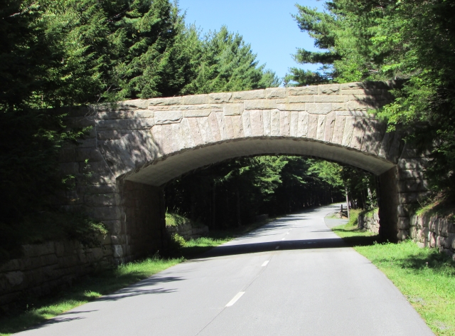
Bridge at Acadia National Park
YouTube
Some of our favorite folks to virtually travel with are full-time RVers. These folks travel all over the country giving tips on where to go and what to do and see. They also give reviews on great camping spots, and we promise that you’re going to see some amazing scenery and points of interest along the way, too. In random order, our top six picks:
Changing Lanes – best for higher end camping and motorcycle rides.
Embracing Detours – best for free camping spots and traveling with pets.
Grand Adventure – best for boondocking in very scenic places.
Traveling Robert – best all around for travel, RV camping, hiking, and scenery.
Less Junk, More Journey – best for traveling the country with small kids.
Long Long Honeymoon – best for tips and tricks along with great destinations.
Texas
Texas
We love for others to see what adventures await in our great home state of Texas. Some of our favorites:
The Daytripper – Chet Garner and crew travel to a new Texas city or town every week – PBS – check listings for times.
Texas Parks and Wildlife – travel to state parks and recreation areas and view our state’s amazing wildlife – PBS – check listings for times.
Texas Country Reporter – ride along with Bob Phillips for amazing places in Texas – various channels – check their website for more information. Here’s a link: Texas Country Reporter
The Texas Bucket List – learn about the people, places, food, and fun that Texas has to offer with host Shane McAuliffe – various channels and times – check their website for more information. Here’s a link: Texas Bucket List
Good Ol’ Buoys
Netflix
We thoroughly enjoyed the two shows listed below. The only problem: they weren’t long enough!
Expedition Happiness – join Salima and Felix as they travel North America in a school bus turned RV – movie – 1.5 hours.
National Parks Adventure – documentary narrated by Robert Redford – 42 minutes.
Water Diamonds
Prime Video
While some Prime Video selections have to be rented, the following are included with an Amazon Prime membership.
The National Parks – America’s Best Idea – 12 part documentary by Ken Burns
America’s 58 National Parks – documentary series with 57 episodes
America’s National Parks – 8 part documentary series
Best Parks Ever – America’s National Parks – 10 part documentary series
America’s Treasures – 8 part documentary series
RV – hilarious 2006 movie starring Robin Williams – 1.5 hours
National Lampoon’s Vacation – 1983 movie starring Chevy Chase – the ultimate guide for what you don’t want a road trip to be – definitely worth another watch
West Texas Sunrise
Books
There’s nothing like a good book. Pick up the hard copies or download a couple of our favorites are listed below.
Dear Bob and Sue – three book series covering Matt and Karen Smith’s adventures while visiting all of the national parks. These are a great read for any national park or travel enthusiast – couldn’t put them down! They have written a couple of other travel-related books, too, so check those out as well.
50 States 5000 Ideas – National Geographic publication which also includes the 10 Canadian Provinces – where to go, what to see, what to do. This is a fun book!
On the Road – classic Jack Kerouac novel published in 1959. If you have never read it, now is a great time.
Any road atlas – yep, we mean that old fashioned paper map book. Atlas trips are a favorite pastime of ours. Pick a state and see what all it has to offer by “traveling” its highways and backroads via map.
Fat Prairie Dog
Around the Web
The possibilities are endless for navigating travel related sites on the web. Here are some of our favorite stops:
RoadsideAmerica.com – pick any city and state to see what quirky attractions await.
AtlasObscura.com – enter a destination in their search box to see what interesting sights can be found there.
Explore.org – a collection of live webcams and webcam videos from around the world. Kids will love this!
OnlyinYourState.com – enter a state in the search box to find out about people, places, and things in the state of your choosing.
TripAdvisor.com we like to search “things to do” in a particular city and state to see what Trip Advisor comes up with.
DearBobandSue.com – check out their website for podcasts, photos of their adventures, and more.
One for the Money Two for the Road Blog – you’re already here, so look through our archives and revisit some great road trip ideas, itineraries, and photos!
Reflections of Boston
We hope our ideas will help you escape for a few minutes or a few hours. Remember to count your blessings, wash your hands, and turn off the news. Stay safe and well, and we will see you when we can get back on the road.
Mike and Kellye
As always, we strive to be as accurate with our information as possible. If we made a mistake, it was unintentional. (Hey, we’re only human!) We aren’t paid for our recommendations, and we only recommend our own tried and true vendors and venues. Our suggestions are for places that we’ve heard good things about but haven’t visited personally, and our opinions are our own.
Lake Mackenzie is a municipal water district reservoir located about seventy miles southeast of Amarillo, Texas. The water district manages campgrounds and recreation areas around the lake. RV with electric and water hook ups and tent camping are available here. (Campers, the campgrounds were nice and clean, but the bathrooms/showers were very dirty.) Currently, speed boats and skiing are prohibited due to low water levels, however, pontoons, kayaks, and motorized fishing boats, as well as jet skis are permitted. We suggest checking with the lake regarding water levels and boating regulations prior to arrival. Lake Mackenzie is a popular fishing lake. There are two beaches for swimming, picnic areas, miles of ATV trails, and group facilities. This is definitely a place to kick back and relax.
For information and fees, here’s a link to the website: Lake Mackenzie
Interesting West Texas history
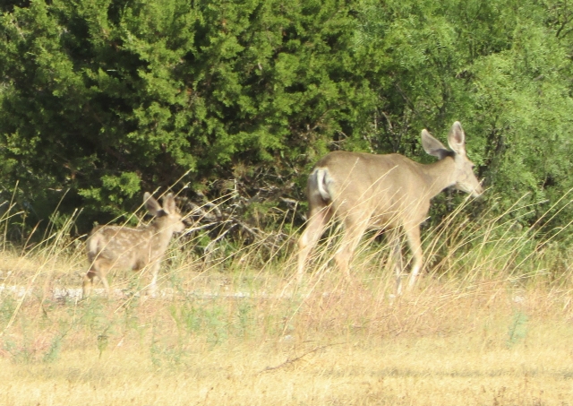
We enjoyed camping at Lake Mackenzie. The relaxing atmosphere was perfect for a weekend trip. During our stay, we saw several deer, a raccoon, a fox, and many different birds.
This mama and baby mule deer pair walked right through our campsite
This beauty got up early to watch the sunrise with us. You would think we had never seen a deer before, but it’s still a thrill to see them in their habitat. We love their curiosity…and their big ears!
Four Canada geese and their early morning reflections on the lake
Side trip: Caprock Canyons State Park is about forty minutes southeast of Lake Mackenzie. (Link to our Caprock Canyons post here: Three Get Ready and Four Let’s Go to Caprock Canyons State Park and Trailway.) Caprock Canyons is home to the Texas State Bison Herd and is a can’t-miss state park. Go not only for the beauty of the red cliffs and canyons, go to see the bison. There is a wonderful scenic drive and miles of hiking trails, too.
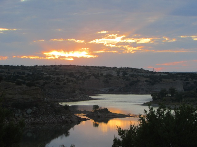
When we camp, we love to get up early for the sunrise, and the Lake Mackenzie sunrises did not disappoint. Neither did the sunsets. We were also treated to two brilliant harvest moons, but unfortunately those didn’t photograph well. Here is our favorite sunrise shot:And, our favorite sunset shot:
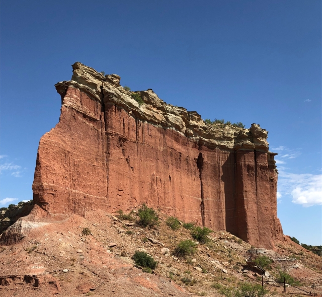
The scenery is breathtaking as you enter the canyon on approach to Lake Mackenzie from the south. It reminded us a little of the area around Moab, Utah, specifically Canyonlands National Park, with its red rock fins, buttes and hoodoos. Y’all know how we love red rocks!
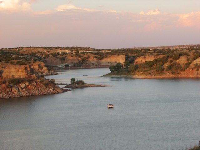
Here are a few more shots of the lake:
Pontoons on a sunset cruise
Cloudy reflections near the beach
That’s going to do it for this weekend trip. We hope you enjoyed Lake Mackenzie as much as we did. Please join us next time for another adventure, tip or trick. You are the reason we post our trips. Become a follower so you never miss a post, and follow us on Facebook, too. Until the next trip…
Travel safe, travel smart, and we will see you down the road.
Mike and Kellye
As always, we strive to be as accurate with our information as possible. If we made a mistake, it was unintentional. (Hey, we’re only human!) We aren’t paid for our recommendations, and we only recommend our own tried and true vendors and venues. Our suggestions are for places that we’ve heard good things about but haven’t visited personally, and our opinions are our own.
Franconia Notch State Park is located in the White Mountain National Forest between the towns of Lincoln, New Hampshire and Franconia, New Hampshire. This park has much to offer in the way outdoor adventures, just to name a few:
Hiking
Biking
Kayaking and canoeing
Scenic Drives
Waterfalls
The Flume Gorge (fee required)
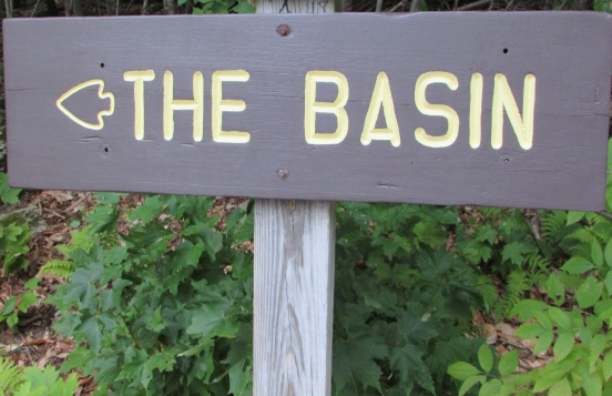
The Basin
Cannon Mountain Aerial Tramway and Ski Resort
Lakeside beach
We had limited time to spend at this park, however, we felt that we got to do most of the things we wanted. We wish we would have had time to take the tram to the top of Cannon Mountain, but it was raining or overcast the whole time we were there. A little rain and a few clouds have never stopped us before, so come along as we do some hiking and see some of the sights at Franconia Notch State Park.
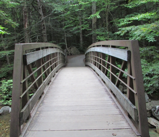
We made a late afternoon stop at The Basin. It was a relaxing walk from the parking lot to the trail, and then a nice little hike along the trail above The Basin.
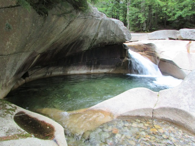
The Basin
Although it looks man made, this granite pothole started being created by rushing water from a melting glacier after the last ice age 25,000 years ago! The Basin is thirty feet across by fifteen feet deep, and the water is almost perfectly clear. Swirling water continues to shape The Basin today.
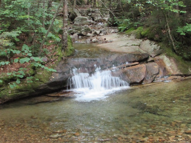
As we hiked the trail above The Basin, we found more small waterfalls and a small flume. The forest in this part of the park was gorgeous.
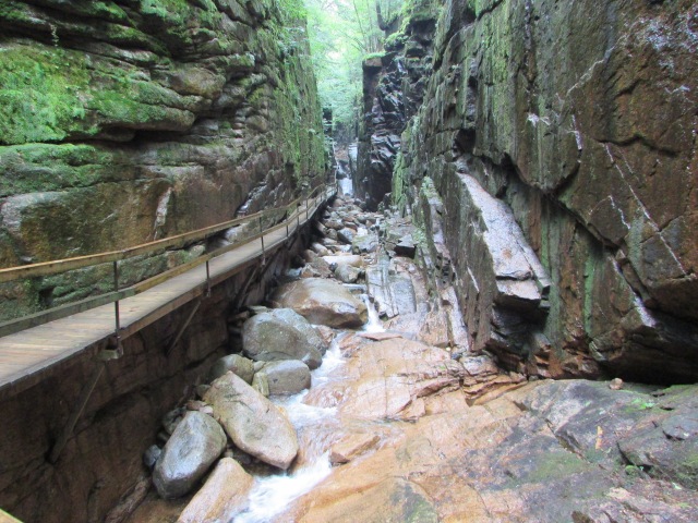
At just under four miles round trip, the Flume Gorge trail was the most strenuous hike of our trip, but it was well worth the effort. As you will see in our pictures below, the scenery is outstanding.
Visitor center and trailhead. Food, a gift shop, and restrooms can be found here.
And, we’re off…
From the trail: the Pemigewasset River
Covered bridge over the river, built in 1986
Avalanche Falls
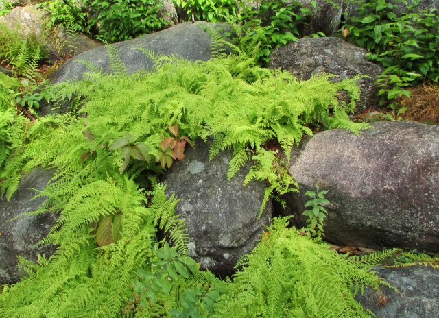
Mosses, plants and trees growing right out of the rocks
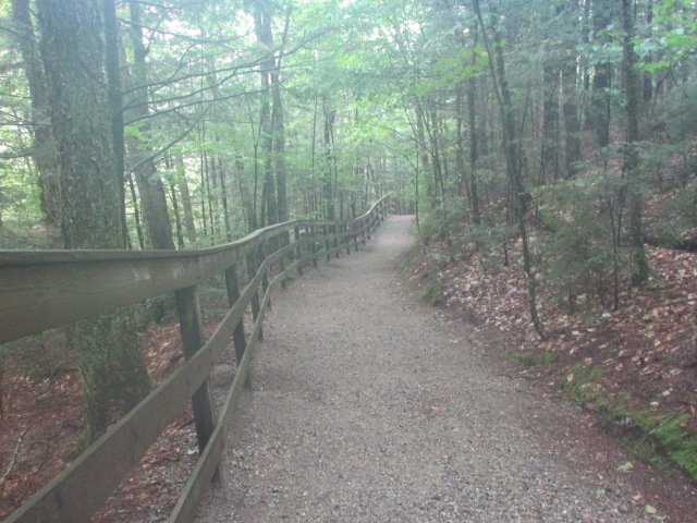
Many different types of trees, shrubs, ferns, mosses, and fungi, made for beautiful scenery in the woods.
View of the trail
Ferns growing on this moss covered log
Ferns
Moss and mushrooms growing on a stump in the middle of the trail
A pretty view of the river from the trail
We’re going to wrap this post here. Thank you so much for joining us at Franconia Notch State Park. We hope you will stop by our site again for more posts from New England, lots of other destinations, and some tips to help make your travels easier. If you’re not already a follower, become one. Follow us on Facebook, and tell your friends about us. We want to be friends with them, too!
We will close this post with a photo of the cloud covered White Mountains of Franconia Notch.
Ghostly clouds dance above the trees at Franconia Notch
Until the next trip…
Travel safe, travel smart, and we will see you down the road (or at a state park!)
Mike and Kellye
As always, we strive to be as accurate with our information as possible. If we made a mistake, it was unintentional. (Hey, we’re only human!) We aren’t paid for our recommendations, and we only recommend our own tried and true vendors and venues. Our suggestions are for places that we’ve heard good things about but haven’t visited personally, and our opinions are our own.
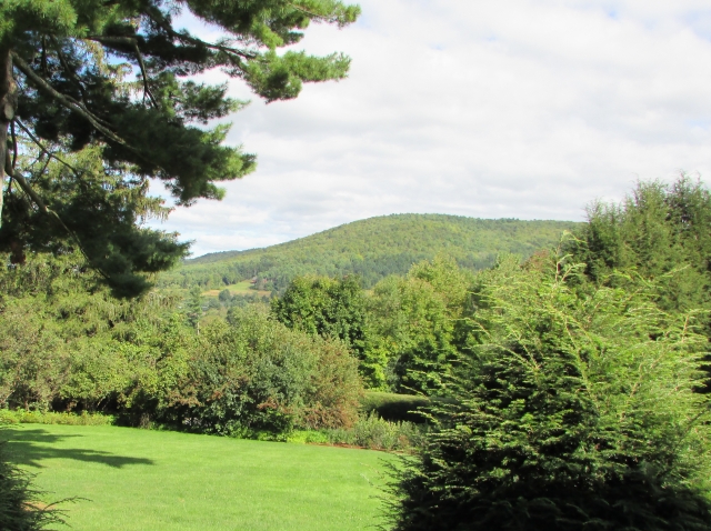
What is it: it was the home of three families who were passionate about preserving and protecting our lands and resources for future generations to enjoy
Where is it: Woodstock, Vermont near the bank of the Ottauquechee River
We recommend purchasing combination tickets for the Marsh-Billings-Rockefeller estate and the also-must-see Billings Farm & Museum, which is across the street.
Accommodations and restaurants in Woodstock, Vermont
When to go? June through October. The visitor center is open and guided tours of the mansion are available 10:00 – 5:00 from Memorial Day Weekend to October 31.
Marsh-Billings-Rockefeller Mansion
What a beautiful property! Full of history and the stories of the three families that called this place home.
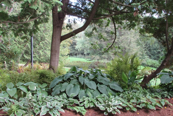
Exquisite gardens
Charles Marsh (1765-1849), a Woodstock, Vermont lawyer and later a US Representative, built the original house in 1805. His son, George Perkins Marsh (1801-1882), was also a lawyer and member of the US House of Representatives. George was appointed as a US Minister to the Ottoman Empire and then to the Kingdom of Italy, where he died in 1882.
One of the carriage roads on the property. Can’t you imagine hitching a horse to a buggy and taking a ride through these beautiful grounds and woods?
George Perkins Marsh was concerned with conservationism and land stewardship. He advocated passionately for preservation of the natural environment, and in 1864, published a book, Man and Nature, which spoke of the importance of minimizing man’s impact on our natural resources.
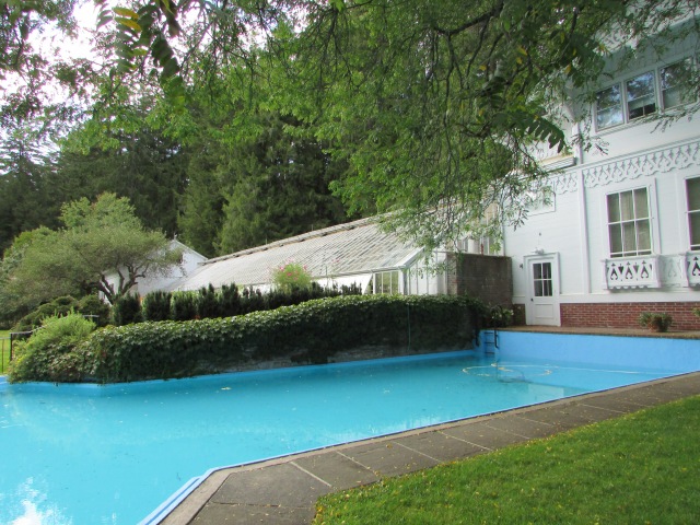
Pool, Belvedere, and Greenhouse
In 1869, the estate was purchased by another lawyer, Frederick H. Billings, who had gained his wealth by handling land claims during the California Gold Rush. Billings was also a founding partner of the Northern Pacific Railroad. The Billings family enlarged the home and transformed the previously boxy, Federal-style home into the trend-of-the-era Queen Anne Victorian that remains today. The Tiffany Glass Company designed several stained glass windows for the home as well as some of the wallpapers and fabrics that remain in the home today.
The belvedere: a summer house or cottage, usually with a view. We loved this tiny treasure.
Billings, also a passionate conservationist, reforested the surrounding woodlands that had been stripped of their trees, and established the dairy farm that lies across the road from the mansion. While not part of the national park (although, they partner with each other in many ways), the Billings Farm and Museum is owned by the Woodstock Foundation, Inc., which was formed by Laurance and Mary Rockefeller.
Looking out from the porch. At one time, there were very few trees in this view due to deforestation. Thankfully, Frederick Billings was good steward of the land.
Mary French Billings Rockefeller, the granddaughter of Frederick Billings, inherited the estate in 1951. She and her husband, Laurance, another passionate conservationist who was an advisor on preservation and conservationism to several presidents, were the last owners of the property. They donated the house and surrounding land to the National Park Service in 1992. Mary died in 1996, and Laurance died in 1997.
Outstanding gardens and plantings at every turn
Trivia: Laurance’s father, John D. Rockefeller donated the land that would become Grand Teton National Park in Wyoming. Laurance donated the land, an 1,100 acre ranch that he and his father acquired over the course of several years, that is now the Laurance Rockefeller Preserve, which also lies within the boundaries of Grand Teton National Park.
Another view of the beautiful grounds
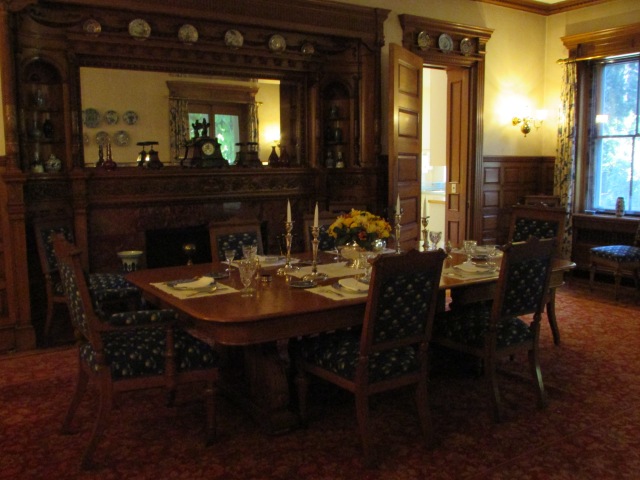
Now for a few shots inside the mansion. General tours cover the first and second floors. Special tours, such as the “art tour”, are given during certain times on select days. Check the website link above for details of these additional tours.
Another Tiffany Glass window as seen in the parlor/music room. Note the fabulous Tiffany wallpaper. This textured wallpaper has been on the walls of this room since the Billings’ renovation in 1869!
The Dining Room. The woodwork in this home is outstanding. The parquet floors are works of art in themselves, and all of the other woodwork is breathtaking.
One of the bookcases in the library.
The home remains as the Rockefellers left it when they donated the property to the National Park Service, even down to the family pictures sitting on the mantel in the library and Laurance’s pipe sitting in a tray in the bedroom.
Master bedroom sitting area. (We’re pretty sure that fan is not orginal to the house)
The mansion is home to an extensive art collection. The collection contains paintings by renowned artists, such as Albert Bierstadt and Thomas Cole, who were associated with the Hudson River School art movement, which, through art and advocacy, promoted conservationism and also led to the establishment of the national park system.
Albert Bierstadt’s The Matterhorn (date unknown)
Many other paintings, sculptures, and photography are also part of the extensive collection of art in the home. We were disappointed that the “art tour” wasn’t offered on the day that we were there. Perhaps another trip to Vermont is in order.
We’re going to wrap up here. Thank you so very much for touring the Marsh – Billings – Rockefeller National Historical Park with us. We love having you join us on all of our travels! Please stop by our site again for more exciting destinations, parks, or maybe just a Quick Stop. We appreciate your “likes” and comments.
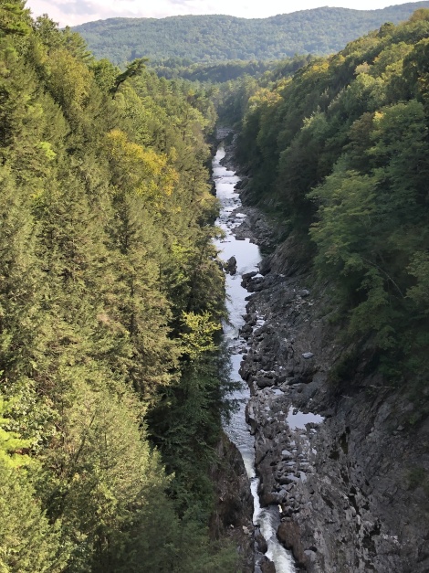
We will close this post with a look at the Ottauquechee River as it flows through Quechee Gorge about five miles from the park.
Quechee Gorge
Until the next trip…
Travel safe, travel smart, and we will see you down the road!
Mike and Kellye
As always, we strive to be as accurate with our information as possible. If we made a mistake, it was unintentional. (Hey, we’re only human!) We aren’t paid for our recommendations, and we only recommend our own tried and true vendors and venues. Our suggestions are for places that we’ve heard good things about but haven’t visited personally, and our opinions are our own.
Cost: $7.00 per person (ages 16 and up) for 7 day pass – seniors free with senior pass
Pine Springs Visitor Center: open daily 8:00 – 4:30 Mountain Time
McKittrick Canyon day use area: gate is open daily 8:00 – 4:30 MST and until 6:00 MDT
Frijole Ranch Museum: open daily 8:00-4:30
Salt Basin Sand Dunes day use area: no overnight parking or camping, picnic tables and pit toilets available – located approximately 50 miles southwest of Pine Springs Visitor Center – no services
Williams Ranch day use area: high-clearance vehicle required for one lane dirt road access – keys must be checked out at the Pine Springs Visitor Center and returned the same day
Camping spaces available at Pine Springs Campground – open year-round – no hook ups and reservations are not available – restrooms and potable water are available
Dog Canyon Campground: open year-round – located 110 miles from Pine Springs Visitor Center, and approximately 65 miles from Carlsbad, New Mexico – tent and RV campsites available – restrooms are available – no services
Backcountry and equestrian camping also available in the park
Hotels, additional camping, food, and gasoline available in Carlsbad, New Mexico and El Paso, Texas
View of the mountains near Guadalupe Pass
Getting There:
Cholla cactus blooms
Guadalupe Mountains National Park is located approximately 53 minutes southwest of Carlsbad, New Mexico and approximately 1.75 hours northeast of El Paso, Texas via US Highway 62/180. El Paso has a major airport.
⇒Travel Tip: there are few services between El Paso and the park. It’s a good idea to have plenty of gasoline, water, and food on hand before beginning your journey. The only services between the city of Carlsbad and the park are 32 miles northeast of Guadalupe Mountains in White’s City near the entrance of Carlsbad Caverns National Park, but the services there are limited. There are no services available in Guadalupe Mountains National Park.
Recommended RV parks in Carlsbad:
Carlsbad RV Park & Campground – 4301 National Parks Hwy, Carlsbad, NM 88220 – (575) 885-6333, which is closest to the national parks.
Carlsbad KOA Holiday – 2 Manthei Rd, Carlsbad, NM 88220 – (575) 457-2000, which is about 30 minutes farther but is close to the state parks in Carlsbad.
Destination: Guadalupe Mountains National Park
The Guadalupe Mountains are the remains of an ancient reef – beautiful!
Guadalupe Mountains National Park is one of two national parks in Texas, the other being Big Bend National Park. Guadalupe Mountains, however, is home to Guadalupe Peak, which is the highest point in Texas at 8,751 feet. The Guadalupe Peak trail, at a little over eight miles round-trip, is a popular and strenuous hike.
Pine Springs Visitor Center
There is an interesting museum exhibit inside the Pine Springs Visitor Center. Guadalupe Peak hikers can check in here. Restrooms and a water filling station are available. Outside, there is a short nature trail (the Pinery trail) leading to the remains of the historic Pinery Station, which was a Butterfield Overland Mail Station (pre-Pony Express) used in the mid-1800s. The remains of this station are some of the only ones left of any Butterfield Station in the US. Learn about some of the plants found in the park while walking the paved Pinery trail.
The Pinery Station
The crumbling walls of the Pinery Station with El Capitan in the background
Highway access and parking for the Pinery Station is approximately .5 miles northeast of the Pine Springs Visitor Center and is clearly marked with signs along the highway. The parking lot here also serves as overflow parking for the Guadalupe Peak trailhead which is located at the Pine Springs campground near the visitor center. The short trail to the Pinery Station is paved and is wheelchair accessible.
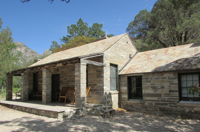
Frijole Ranch
The Frijole Ranch house, originally built in 1876 and expanded in the 1920s, is now a cultural museum. The ranch was established in order for its owners to raise cattle near several springs located here in the foothills of the Guadalupe Mountains. Subsequent owners grew vegetable gardens and tended large orchards along with raising stock. Click the park website link above to read about the interesting history of the ranch.
The orchards are behind the white building (which could be an outhouse) on the left. The tin roofed building on the far right was used as a bunkhouse and schoolhouse.
Access to Frijole Ranch is via a well-marked exit off of the highway northeast of the Pine Springs Visitor Center. A short gravel road will lead to a parking and picnic area (with restrooms) next to the Frijole Ranch house/museum. Equestrian corrals and overnight parking for stock trailers are available at Frijole Ranch. This is also the trailhead for Manzanita Spring trail and Smith Spring trail. The Manzanita Spring trail is an easy 4 miles round-trip on a paved, wheelchair accessible trail. Smith Spring trail loop is classified as moderate at 2.3 miles round-trip.
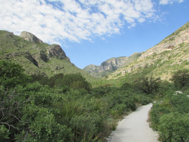
Hiking McKittrick Canyon
Here you can see a wide variety of plants, and possibly some animals that call Guadalupe Mountains National Park home. That, on top of the breathtaking beauty of the mountain scenery, makes McKittrick Canyon a wonderful place to hike. Oak, maple, walnut and many other types of trees can be found in this desert-turned-riparian hideaway. When the trees turn in the late fall, the canyon becomes an even more popular place for hikers. Check the website for the fall colors report in October and November.
Starting off on the trail leading from the ranger station/contact station where all hikers must check in. Didn’t we have a gorgeous day for hiking?
A cool creek is a welcome sight on a hot day
Pratt Cabin – note the stone roof
Wallace Pratt, a Humble Oil Company geologist, first came to McKittrick Canyon in 1921, and eventually acquired about 5,000 acres of the canyon. In the early 1930s he hired Houston, Texas architects and local workers in need of jobs to construct the cabin also known as the Pratt Lodge. Mr. Pratt referred to the cabin as the Stone Cabin, which was constructed of locally quarried limestone. Pratt eventually built another home in what is now Guadalupe Mountains National Park. His second home, completed in 1945, is known as the Ship on the Desert. In 1960, the Pratt family donated their land to the park service. The cabin is open intermittently for ranger guided tours, and there are a couple of picnic tables nearby but no restrooms or water.
View from the front porch of Pratt Cabin – we could have stayed on that porch all day
This little lady was as curious about us as were about her
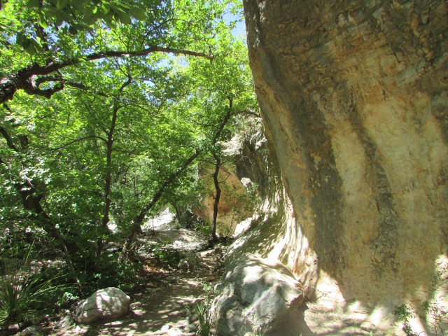
A shady part of the trail leading to The Grotto
The well-marked turn-off for McKittrick Canyon is located 7 miles northeast of the Pine Springs Visitor Center. Although we went on a hot day, this was one of our all time favorite hikes. It is rated moderate, however, we thought it was an easy, family friendly trail. We turned around at The Grotto (6.8 miles round-trip), but the trail continues to McKittrick Ridge which is a steep and strenuous 14.8 mile round-trip hike from the ranger/contact station trailhead. Restrooms and water filling stations are available at the station. Park passes/admission fees can be paid at the station, however, they require exact change in the form of cash only. Park passes can also be obtained at the Pine Springs Visitor Center.
Below are a few more shots from McKittrick Canyon trail.
Cute and colorful – we saw several of these guys along the trail
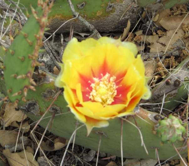
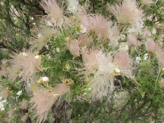
One of our favorite things to see on this trip was the blooming New Mexican agave plants, even though the only ones we saw were in Texas!
We visited the park during the latter part of May when many of the plants were in bloom. Desert plants are magnificent when in bloom, and if you’ve never experienced the refreshing summer rain scent of the creosote plant, you’re totally missing out!
Agaves and yucca plants produce tall stalks that can grow several feet overnight. Many desert animals eat the blooms and the stalks. We watched a mule deer in McKittrick Canyon gobble up an entire century plant stalk in about five minutes.
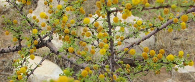
The normally scraggly-looking cactus plants put on a show during the spring with their brightly colored blooms, such as the cholla cactus shown at the top of the page.
Some of the other plants that were in bloom included:
Soap Tree Yuccas
Butterfly Weed
Prickly Pear Cactus
Apache Plume with its white flowers and feathery pink plumes
Delicate Prickly Pear “rosebuds” about to burst into bloom
Bright orange Ocotillo blooms and a bee
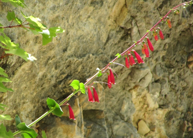
Cardinal penstemon growing straight out of a rock at The Grotto
Another agave shot – not sorry. This was a large “agave forest” (our words) just outside the park.
Below are some of the plants and sights that we saw along the road in Lincoln National Forest on the way to Dog Canyon. Some of the plants looked like they had been purposely planted, but that didn’t bother us. We loved taking the back roads and seeing these plants off the beaten path!
Creosote Bush – and oh, did it smell heavenly
Yellow Bird of Paradise Bush
Sweet Acacia
Free range cattle jam on the road – and this wasn’t the only one we encountered
This is the state line marker on the gate going in to Dog Canyon campground. Most of the trek to Dog Canyon is through New Mexico, but all of Guadalupe Mountains National Park is in Texas. Remote Dog Canyon is THE place to camp if you want to get away from it all.
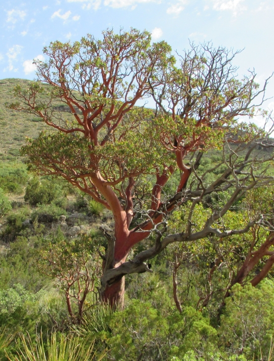
We will close this post with a shot of a spectacular Texas Madrone.
Texas Madrone trees shed their bark to expose their smooth pink wood
Thank you for hanging with us through this long post. There is just so much beauty in Guadalupe Mountains National Park we wanted to share it with you! (And we barely scratched the surface.) We appreciate you traveling along with us on our journeys, and we hope you will stop back by soon for more great road tripping and RVing tips and more exciting adventures. Until then…
Travel safe, travel smart, and we will see you down the road.
Mike and Kellye
As always, we strive to be as accurate with our information as possible. If we made a mistake, it was unintentional. (Hey, we’re only human!) We aren’t paid for our recommendations, and we only recommend our own tried and true vendors and venues. Our suggestions are for places that we’ve heard good things about but haven’t visited personally, and our opinions are our own.


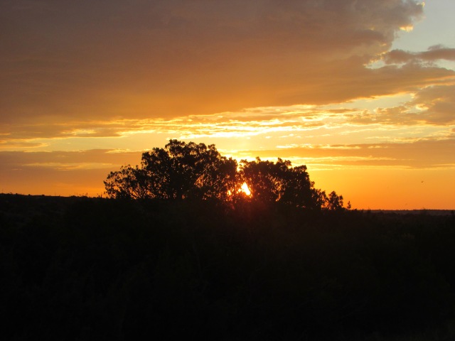


 And, our favorite sunset shot: