Featured

Harpers Ferry National Historical Park

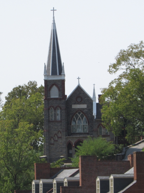
The town of Harpers Ferry is a national park located (now) in the state of West Virginia, but it also borders the states of Maryland and Virginia. The town once had an armory (established by George Washington to build muskets), a cotton mill among other important manufacturing sites, and a college. It is also the site of the 1862 Civil War Battle of Harpers Ferry, when the town was in the state of Virginia.

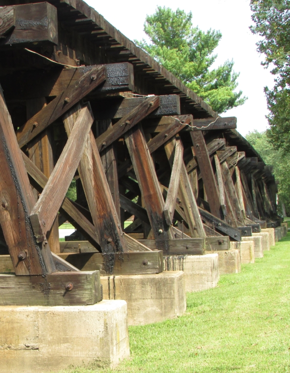
Here visitors can hike a section of the Appalachian Trail, walk the C & O Canal towpath (part of the Appalachian Trail), or enjoy several other hiking trails. There are also outfitters nearby that can put you on a river if water sports are your thing. Several museums and other points of interest are located along Potomac and High Streets in the lower town.
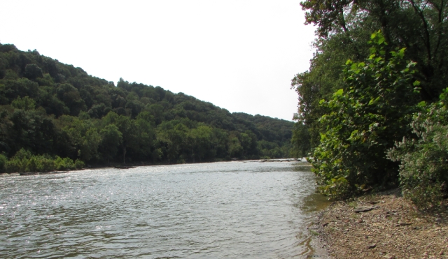
The Appalachian Trail winds its way from Maryland Heights across the Potomac River and through Harpers Ferry
Peaceful path to Virginius Island

The Rivers

The Point is where two rivers converge. This is a popular place in the park. It is interesting to see the water of the Potomac blend with the water of the Shenandoah where they meet at the center of the image.

The forest green water of the Potomac (foreground) flows into the olive green Shenandoah (background)
Along the bank of the Shenandoah

The Town

When visiting Harpers Ferry, guests can park at the visitor center then board a free shuttle to take them to the lower town. A hiking trail leads to the lower town for those who would rather walk. There are many historic buildings to see and there are also shops and restaurants. Although it is a national park, Harpers Ferry does have residents.

High Street
Along Shenandoah Street
Saint Peter’s Roman Catholic Church

John Brown

John Brown was a staunch abolitionist. In 1859, he organized a raid on Harpers Ferry. The rebellion, which was intended to arm enslaved men by seizing the armory, was a failure. After a thirty-six hour standoff, Brown and his men were killed or captured by a group of US Marines led by Robert E. Lee. Brown was later found guilty of treason, inciting a riot, and conspiracy. His trial and subsequent hanging took place in Charles Town, Virginia, now West Virginia.

John Brown’s Fort was originally the firehouse for the armory in Harpers Ferry. It is now referred to as John Brown’s Fort because it is where he and his men barricaded themselves during the final hours of their raid before being captured.
This and the photo above were taken at the National Civil War Museum in Harrisburg, Pennsylvania

It is reported that Brown wrote this on the wall of his cell just before being hanged: “I, John Brown, am now quite certain that the crimes of this guilty land will never be purged away but with blood.”

Miscellany

The Harpers Ferry train tunnel is actually on the Maryland side of the Potomac River
Remains of a B & O Railroad bridge which spanned the Potomac River at Harpers Ferry. While these piers are newer, railroad bridges here were destroyed and rebuilt nine times during the Civil War, however, five of those times the bridges were destroyed by floods.
Shenandoah Bridge near The Point at Harpers Ferry. The bridge was originally constructed in 1882. It was destroyed by a flood in 1889 and rebuilt. These piers are all that remain after another major flood destroyed the bridge in 1936.
Ruins along Virginius Island Trail
Train trestle currently used by Amtrak and a commuter train service

We’re going to wrap up our visit to Harpers Ferry here. Thanks so much for joining us on the road. We hope you will come back again to enjoy more of our Mid-Atlantic road trip. Until next time…

Travel safe, travel smart, and we will see you down the road.

Mike and Kellye

IMG_2120

As always, we strive to be as accurate with our information as possible. If we made a mistake, it was unintentional. (Hey, we’re only human!) We aren’t paid for our recommendations, and we only recommend our own tried and true vendors and venues. Our suggestions are for places that we’ve heard good things about but haven’t visited personally, and our opinions are our own.

©2021

Black Hills of South Dakota – Day Three

IMG_1448

→Note: this post is the third in a series as we cover a week long vacation itinerary. Our trip starts at Rapid City, South Dakota. 

Day Three

Destination: Custer State Parkimg_1266-e1534024838736.jpg

  • Website link: Custer State Park
  • Cost: $20.00 per car for one week pass (as of August, 2018).
  • For the best wildlife sightings, arrive early in the morning or early in the evening.
  • This park has everything from biking to hiking to horseback riding to swimming.

Travel tip: this will be a full day trip. Pack road snacks and plenty of water, along with a fully charged camera battery/phone and a picnic lunch. Or, drive (15 minutes) in to the city of Custer and have lunch.

*Recommended restaurant in the city of Custer: Black Hills Burger and Bun Co – 441 Mt Rushmore Rd. Their burgers rank in our top three best ever, and their cheese curds… All we can say is you’ve gotta try ’em!

IMG_1262
View from Custer State Park

From Rapid City take Highway 79 south to Highway 36 west. Continue west on Highway 16A to the park entrance. Drive time: 45 minutes.

Travel tip: Custer State Park is a place where you could spend an entire week and never have to leave the park. Great vacation destination by itself, and one of our very favorite state parks.

Lodges, cabins, tent and RV camping available in the park. Hotels available in the city of Custer.

*Recommended hotel in the city of Custer: Holiday Inn Express.

IMG_2608 (1)
Pronghorn herd

After entering the park, turn south on to Wildlife Loop Road for potential wildlife sightings of all kinds, including herds of bison and pronghorn. Look for prairie dogs, turkeys, and other wildlife along the way, too. Take your time while driving this road, and stop at the visitor centers for information about the park. Check out the lodges or campgrounds while you’re here so you can plan a trip back in the future!

IMG_1264
Along Needles Highway

At Highway 16A turn left to go to the city of Custer or turn right to go east to Highway 87, then turn north on to Highway 87 (Needles Highway).

Travel tip: Needles Highway has low, narrow tunnels. Check with the park before attempting to navigate this road in/with a large vehicle or RV.

Continue on Highway 87 northwest to Sylvan Lake. Drive slowly, and take advantage of the pull outs for the many photo ops along this road. Sylvan Lake is the perfect spot for a picnic lunch and then a hike or walk around the lake. Nice visitor center/store here, too.

img_1245.jpg
Sylvan Lake

IMG_1263
Panorama along Needles Highway

IMG_1271
Center Lake – good place to fish

IMG_1260
Narrow tunnel

IMG_1256
Needles

Backtrack south on Needles Highway to US Highway 16A. Turn left (east) and take US Highway 16A to Highway 36, and then Highway 79 north to Rapid City. Drive time: 1.5+ hours.

Alternate route: From Sylvan Lake, continue north on Highway 87 to US 385 toward Hill City. Stay on 385 north then take Highway 44 east to Rapid City. Drive time: 1 hour.

IMG_1248

That’s our wrap up of Custer State Park. We hope your trip there is as amazing as we think it will be. Check our site next week for Day Four of our Black Hills itinerary. Until then…

Travel safe, travel smart, and we will see you down the road.

Mike and Kellye

IMG_2120

As always, we strive to be as accurate with our information as possible. If we made a mistake, it was unintentional. (Hey, we’re only human!) We aren’t paid for our recommendations, and we only recommend our own tried and true vendors and venues. Our suggestions are for places that we’ve heard good things about but haven’t visited personally, and our opinions are our own.

©2018