Featured

Ulysses S. Grant National Historic Site

About the site

Ulysses S. Grant National Historic Site preserves the history of White Haven, the 200-year-old estate that was once home to Ulysses S. Grant and his wife, Julia Dent Grant. The park is located at 7400 Grant Road, St. Louis, Missouri.

The house was painted Paris Green in 1874 during Grant’s presidency and was repainted the same color during its restoration in the 1990s. The red buildings behind the house are the icehouse and chicken coop. We only took a couple of non-post-worthy pictures inside the house because our guide, Ranger Evan, was extremely interesting to listen to as she led us through the property.

Highlights of the park include:

  • Visitor center and gift shop/bookstore
  • Introductory film
  • Museum
  • Self-guided walk through the grounds
  • Self-guided tour featuring the historic trees on the property
  • Ranger-led tours of the house
  • Junior Ranger programs
  • John Y. Simon Research Library – by appointment only

The park’s website link: Ulysses S. Grant National Historic Site

Importance of the historic site

Ulysses S. Grant was not only the victorious commanding general of the Union Army during the Civil War, but he was also the 18th President of the United States. Grant served two terms as president from 1869 – 1877. His wife and First Lady, Julia Dent Grant spent her childhood at White Haven. Her father, Frederick Dent, who was a successful merchant and land speculator, purchased White Haven in 1820 as a country get away from the family’s city home in St. Louis. It is hard to imagine today that the family’s second home was only twelve miles from their primary residence.

Historic photo, White Haven, circa 1860
Another view of the house that we almost matched to the historic image above. The white structure behind the house is a kitchen and laundry.

Ulysses and Julia at White Haven

Ulysses met Julia in 1843 when he visited White Haven with his former West Point roommate who happened to be her older brother, Fred. After courting for only four months, Julia accepted Ulysses’ proposal, which they kept secret for over a year. However, due to the outbreak of the Mexican-American War they wouldn’t marry until 1848. Ulysses served in the U.S. Army for eleven years prior to resigning and joining his wife at White Haven in 1854 to try farming. He built a cabin on an 80-acre plot that Julia’s father had given the couple as a wedding gift, and they named the property Hardscrabble. While Grant owned one enslaved worker, a man named William Jones who had been given to him by Julia’s father, he also hired free men to work on the farm.

Hardscrabble – photo from the Library of Congress. The Grants lived in this cabin for only three months. Upon the death of her mother, Julia’s father asked her, Ulysses, and their two children to live in his White Haven home with him. They never returned to Hardscrabble. The cabin can now be seen at the family amusement venue, Grant’s Farm, which is next door to the historic site.

Grant’s Pre-Civil War Years

By 1858 Grant, now with four children, was unable to support the family by farming, but instead of selling his one slave to make money he freed the man. Slavery was a topic on which he and his father-in-law greatly differed, as Frederick Dent’s White Haven was a slave plantation. Nonetheless, after failing at farming and on the verge of being penniless, Grant leased Hardscrabble and moved his family to St. Louis where he began a real estate venture. Unfortunately, real estate was not a successful career either, so he moved his family to Galena, Illinois and went to work in his family’s leather goods business. During this time Frederick Dent lost much of White Haven to foreclosure. He also began deeding acreages to his children. Then in December of 1860, South Carolina became the first state to secede from the Union. By February 1861, six other states had seceded and had formed the Confederate States of America. The Civil War had begun.

This view of the back of the house shows the kitchen and laundry that was separate from the house.

Grant’s Civil War Years

After the war began, the governor of Illinois appointed Grant to lead a regiment of volunteers. Grant was so successful in training the men and gaining their respect that President Abraham Lincoln promoted him to Brigadier General. As the war continued, Lincoln became displeased with the North’s military leadership. Therefore, in March of 1864, Lincoln appointed Grant General-in-Chief of the U. S. Army, a rank that had only ever been held by George Washington. Over the following year Grant, who sometimes joined his subordinates in battle, successfully led the North to victory. Despite heavy casualties, he settled for nothing less than unconditional and immediate surrenders, which earned him the nickname, “Unconditional Surrender Grant”. The war ended on April 9, 1865, with the South’s General Robert E. Lee surrendering to Grant at Virginia’s Appomattox Courthouse.

Lee surrenders to Grant – Library of Congress image

Grant’s Post-Civil War Years

After the war, President Andrew Johnson appointed Grant Secretary of War of the reconstructing nation. During and after the war the Grants had purchased White Haven from Julia’s siblings and father and regained Hardscrabble. In 1868, Grant was elected President of the United States, having won against incumbent Andrew Johnson. The Grants moved into the White House in 1869 and hired Ulysses’ cousin’s husband to manage the farm at White Haven. By this time, Dent’s former enslaved workers had left, and French and German immigrants were hired as laborers. Grant had a barn and stables built at White Haven and began buying horses. The Grants visited White Haven as often as possible and planned to spend their retirement years there. However, the farming and livestock operation failed to make money, so in 1875, Grant sold White Haven’s assets and leased out the property. They would never return.

This stable housed Grant’s thoroughbreds. Today it houses the park’s museum.

Trivia: General Grant and Julia had been invited to join President Lincoln and the First Lady in the balcony of Ford’s Theater on April 15, 1865, the night the President was assassinated. However, the Grants had declined the invitation due to Julia wanting to visit relatives in New Jersey.

Ulysses S. Grant standing next to his wife Julia Dent Grant, who is sitting
Ulysses and Julia in 1864 or 1865 – National Park Service photo.

Grant’s Post-Presidency Years

Julia had wanted her husband to run for a third presidential term, but he refused by publicly renouncing his interest. The former President and First Lady set off on a two-year world tour, fulfilling Grant’s lifelong dream of travel.  Upon their return to the U.S., he sought to win the Republican nomination for president in the 1880 election, but the party chose James A. Garfield as their candidate. Ulysses and Julia settled in New York to be closer to their children and grandchildren. Grant was diagnosed with throat cancer in the summer of 1884. Early in 1885, the former president began writing his memoirs. Three months before his death, Grant found that he had lost his fortune to an investment scam perpetrated by his son Jesse’s business partner. Because of the swindle, the Grants also lost White Haven. He completed his memoirs just three days before his death on July 23, 1885.

Ulysses S. Grant

Museum Exhibits

Click on an image to view as a gallery.

The Grant Family: Nellie, Ulysses, Jesse, Frederick, Julia, and Ulysses, Jr.

Trivia: Ulysses S. Grant is not the former president’s actual name. His given name was Hiram Ulysses Grant. However, when his congressman submitted Ulysses’ application to West Point, he mistakenly wrote down Ulysses Simpson Grant, Simpson having been Ulysses’ mother’s maiden name. After attempting to correct the mistake at West Point to no avail, Ulysses finally gave up and signed his name as Ulysses S. Grant. The name would follow him throughout the rest of his life and into history.

Thank you so much for joining us on our visit to Ulysses S. Grant National Historic Site. We learned a lot during our visit, and we hope you did too.

Want to learn about other American presidents? Click on these great parks:

Lyndon B. Johnson National Historical Park

Eisenhower National Historic Site

Monticello

Travel safely, and we will see you on the road.

Mike & Kellye

IMG_5646

As always, we strive to be as accurate with our information as possible. If we made a mistake, it was unintentional. (Hey, we’re only human!) We aren’t paid for our recommendations, and we only recommend our own tried and true vendors and venues. Our suggestions are for places that we’ve heard good things about but haven’t visited personally, and our opinions are our own.

©2022


Featured

Lyndon B. Johnson National Historical Park

Our road trip begins in Johnson City, Texas where the Lyndon B. Johnson National Historical Park Visitor Center is located. Johnson City is:

  • 48 miles/1 hour west of Austin, Texas – Website link: Visit Austin
  • 64 miles/1.25 hours north of San Antonio, Texas – Website link: Visit San Antonio

The Lyndon B. Johnson National Historical Park is divided into three sections: the Johnson City section, the state park section, and the LBJ Ranch section. The state park and ranch sections are 14 miles west of Johnson City in Stonewall, Texas via U.S. Highway 290. We recommend visiting all three of the park sites to get a complete overview of Johnson’s life and legacy as the 36th president of the United States. 

Website link: Lyndon B. Johnson National Historical Park

Bridge on the path between Johnson Settlement and Lyndon Johnson’s boyhood home

Johnson City

The park’s visitor center museum in Johnson City features a timeline of the president’s life, photos, and other historical information. Artifacts from Lyndon Johnson’s presidency as well as some items that belonged to his wife, Lady Bird, are also on display. Johnson’s boyhood home sits across the street from the visitor center, and down the street is Johnson Settlement where his grandparents settled after the Civil War. Easy trails, sidewalks, and wayside information boards make an interesting and pleasant walk between the sites. 

Johnson’s Boyhood Home 
Lyndon B. Johnson’s boyhood home

Lyndon Baines Johnson was born on what is now the LBJ Ranch near Stonewall, Texas in 1908, and the family moved to Johnson City when he was five years old. The Johnsons lived in the home for 24 years while raising their five children, including three girls and two boys. In the early 1970s, the modest family home was restored to its 1920’s style by the National Park Service with help from the former president. The property also features a shed, a windmill and cistern, and a small barn surrounded by gorgeous old oak trees. Check the park’s website for tour information.

Windmill behind Lyndon Johnson’s boyhood home

Lyndon’s father, Sam Ealy Johnson, Jr., was a Texas legislator for 12 years, and his mother, Rebekah Baines Johnson, was an educator. LBJ attended Texas State Teacher’s College. For a short time, he worked as a teacher and principal to earn money to continue his college education. After graduation from college, he attended one semester of law school at Georgetown University before dropping out. 

Shed behind Lyndon Johnson’s boyhood home
LBJ the Politician

In 1937, Johnson announced his bid for the U.S. House of Representatives for the 10th District of the State of Texas from the east porch of his boyhood home. He won the election and later went on to serve in other capacities primarily as a U.S. Senator and Senate Majority Leader. LBJ ran for president in 1960 but lost the Democratic nomination to John F. Kennedy. Johnson was asked by Kennedy to be his running mate due to LBJ’s popularity with the southern Democrats who weren’t especially fond of JFK. The duo won the election, and the rest, they say, is history. On November 22, 1963, while standing aboard Air Force One at Dallas’s Love Field airport, Vice President Lyndon B. Johnson was sworn in as president two hours after the assassination of President John F. Kennedy.

The east porch of LBJ’s boyhood home
Johnson Settlement

A block west of Lyndon Johnson’s boyhood home is Johnson Settlement, which is the site of his grandparents’ original home. In the mid-1800s, Sam Ealy Johnson, Sr. and his brother Tom settled on 320 acres in what is now Johnson City and began a successful cattle driving business. Sam returned to Texas after serving the Confederacy in the Civil War and married Eliza Bunton in 1867.

LBJ’s grandparents, Sam and Eliza Johnson, lived in this cabin from 1867-1872
This barn was added to the property by James Polk Johnson for whom Johnson City is named and who was a nephew of Sam Ealy Johnson, Sr.
This cooler house, windmill, and cistern were also added to the site by James Polk Johnson

Lyndon B. Johnson State Park and Historic Site

The next stop on our road trip is in Stonewall, Texas at the Lyndon B. Johnson State Park and Historic Site. The park is located 14 miles/15 minutes west of Johnson City on U.S. Highway 290. 

State Park
The Lyndon B. Johnson State Park Visitor Center

The state park site is adjacent to the Lyndon B. Johnson National Historical Park/LBJ Ranch along the banks of the Pedernales River. This park features:

  • Visitor center and gift shop plus memorabilia from LBJ’s presidency 
  • Olympic-sized swimming pool – open in the summer
  • Historic cabin tours
  • Sauer-Beckmann Living History Farm
  • Hiking trails
  • Tennis courts
  • Fishing (no license required if fishing in the state park) 
  • Longhorn herd
  • Bison herd

Website link: Lyndon B. Johnson State Park and Historic Site

Bison at the Lyndon B. Johnson State Park and Historic Site
Sauer-Beckmann Living History Farm

Located within the state park is the Sauer-Beckmann Living History Farm. Here rangers and park volunteers dress in period clothing and take on the chores of managing an early 20th century home and farm. Volunteers give tours of the buildings, grow gardens and cotton from heirloom seeds and take care of the animals that live on the farm. 

Barn and blacksmith shop
Sheep and other animals live at the historic farm

It’s about a 10-minute walk from the visitor center to the farm. The farmhouse, which was later added on to, was built in the late 1800s by the Sauer family. Interestingly, one of the Sauer’s older daughters was the midwife who attended Lyndon Johnson’s birth in 1908. The Beckmann family bought the farm in 1900, and they remained neighbors of the Johnsons until the property was sold to the Texas Parks and Wildlife Department in 1966.

Lyndon B. Johnson National Historical Park

Stop number three on our road trip is the Lyndon B. Johnson National Historical Park/LBJ Ranch. The drive from the state park visitor center to the ranch entrance takes about ten minutes, and the auto tour through the ranch takes about 1 to 1.5 hours depending on stops.

Lyndon and Lady Bird

After his short stint at Georgetown Law, Lyndon met University of Texas graduate, Claudia Alta Taylor. As an infant, Claudia had been called Lady Bird by her nanny, and the nickname followed her throughout her life. LBJ asked Lady Bird to marry him on their first date, and she promptly declined. More proposals and refusals were made over the next ten weeks until Lady Bird finally said yes. The couple were married in November of 1934. LBJ liked being known by his initials, and he also like having them attached to everything he owned, including his ranch and cattle! Having a wife with his initials must have been quite a boost to LBJ’s reportedly huge ego. They named their children Lynda Bird Johnson and Luci Baines Johnson. Even the family’s dog, Little Beagle Johnson, had the same initials. 

LBJ Ranch 

Upon approach to the park visitors will see Trinity Lutheran Church which sits just across the river from the LBJ Ranch entrance. The church was registered as a Texas Historic Landmark in 1989.

Trinity Lutheran Church, built in 1904
The final resting places of Lyndon and Lady Bird Johnson in the family cemetery on the ranch

As a kid, Lyndon spent summers on what is now the LBJ Ranch helping his aunt and uncle work cattle and doing odd jobs. After her husband died, LBJ’s aunt asked if he wanted to buy her floundering property, and he jumped at the opportunity. He quickly began purchasing registered Hereford cattle. Over the years, Lyndon and Lady Bird expanded the ranch by purchasing additional land, growing the ranch to over 2,700 acres. When the historical park was being established, the Johnsons opted to donate a portion of the ranch to the National Park Service. Their only condition was that it would continue as a working cattle operation. The park service agreed, and descendants of LBJ’s original prizewinning Herefords still thrive on the ranch today. 

Some of the descendants of LBJ’s prizewinning Hereford cattle
LBJ’s Texas White House
LBJ’s Jetstar, nicknamed Air Force One-Half. This smaller jet was used to carry the president home from a nearby airport where Air Force One had landed because the runway at the ranch couldn’t accommodate a large jet.

The buildings surrounding the airplane hangar (now a visitor center) pictured below are garages, offices, and a secret service command post. These buildings sit behind and to the side of the ranch house. The runway is now the visitor center parking lot. 

Airplane hangar, now visitor center, on the LBJ Ranch

The media began referring to his home as the Texas White House because Johnson spent so much time at the ranch during his presidency. The president held meetings on the lawn under a large live oak tree where members of the cabinet conducted government business from lawn chairs. Foreign ministers, former presidents, and other dignitaries spent time at the LBJ Ranch, and the president even held press conferences from the porch. 

The Texas White House/LBJ Ranch house
The pool and pool house sit in the side yard next to the house
Final view of the Texas White House

Nearby Points of Interest

Click the links below for information on these points of interest in the Texas Hill Country beginning from Johnson City:

Thank you for joining us on our Texas Hill Country road trip! We hope you enjoyed the visit to the Lyndon B. Johnson National Historical Park.

Want to learn more? Click to see these other exciting historical sites: 

San Antonio Missions National Historical Park

Eisenhower National Historic Site

Antietam National Battlefield

Harpers Ferry National Historical Park


Travel safe, travel smart, and we will see you down the road.

Mike and Kellye

IMG_2120


As always, we strive to be as accurate with our information as possible. If we made a mistake, it was unintentional. (Hey, we’re only human!) Our opinions are our own.

©2022


Featured

Fort McHenry National Monument and Historic Shrine

Sitting right on Baltimore’s inner harbor near an industrial area on the edge of downtown is Fort McHenry, the birthplace of the “The Star-Spangled Banner”. It was during the War of 1812 that a young lawyer named Francis Scott Key penned the now famous words. He had been aboard a US truce ship on the river while witnessing the battle between the Americans defending Baltimore at Fort McHenry and the British navy. The British had sailed up the Chesapeake Bay after burning Washington and filled the river with its ships aiming to capture Baltimore. After the battle in September of 1814, Key was inspired to write the poem when he saw that the garrison flag “yet waved” by the dawn’s early light over Fort McHenry. The poem was set to an adapted tune of an 18th Century European song called “To Anacreon in Heaven”, and in 1931 “The Star-Spangled Banner” was officially adopted as the National Anthem of the United States. Did you know that the original title of Key’s poem was “The Defense of Fort McHenry”?

A smaller replica of the original garrison flag, which bore fifteen stars and fifteen stripes and measured 30′ x 42′, flies over Fort McHenry today. The original flag, made by Mary Pickersgill of Baltimore at the request of the fort’s commander, Major George Armistead, now resides in the National Museum of American History at the Smithsonian Institution in Washington, DC.

Fort McHenry was built between 1798 and 1803 and is named for James McHenry who hailed from Baltimore and was George Washington’s Secretary of War. During the Civil War, the fort was used to hold prisoners of war, but it was primarily used as a prison for pro-succession Maryland residents. During World War I, the grounds around Fort McHenry were home to 100 buildings composing a 3,000 bed hospital. Called General Hospital 2, which was one of the largest in the US at the time, it was used to treat wounded from the battlefields of France. Fort McHenry is the only national park site that has been designated as a shrine.

Prison cells at Fort McHenry
These cannons swivel on a round track so they can be aimed in different directions
These cannons are aimed toward the harbor. Baltimore’s harbor is actually the Patapsco River which flows into the Chesapeake Bay.
Inside the fort
Outside the fort
Sallyport (entrance) to the fort

We’re going to call this trip done, but in closing the post we want to leave you with a couple of cool shots at Oriole Park at Camden Yards. This is where the Baltimore Orioles baseball team plays, and the stadium is next to M&T Bank Stadium where the Baltimore Ravens football team plays. Both fields are in downtown Baltimore.

Eutaw Street Entrance
The great Babe Ruth was a Baltimorian who was born just a few blocks from Oriole Park at Camden Yards. In fact, his father once owned and ran a bar that sat about where the ballpark’s second base is located today.

Thanks so much for stopping by! Until the next time…

Travel safe, travel smart, and we will see you down the road.

Mike and Kellye

IMG_2120

As always, we strive to be as accurate with our information as possible. If we made a mistake, it was unintentional. (Hey, we’re only human!) We aren’t paid for our recommendations, and we only recommend our own tried and true vendors and venues. Our suggestions are for places that we’ve heard good things about but haven’t visited personally, and our opinions are our own.

©2021


Featured

Wish We Were There Wednesday: Random Places

Today we’re taking a random places road trip, and we are so happy to have you along for the ride. Enjoy!

Pike Place Market, Seattle. Established in 1907, it is the oldest running farmer’s market in the U.S. The original Starbucks opened here in 1971.

The Green Monster left field wall at Fenway Park, Boston. The reason the wall is there? To keep people from watching the game for free. In 2003, 269 barstool seats and 100 standing room only spaces were added to the deck on the wall, however tickets for those seats are hard to come by. By the way, the scoreboard on the Green Monster is still updated by hand. Fenway Park has been the home of the Boston Red Sox since 1912.

Smokey Bear’s gravesite, Capitan, New Mexico. The idea of a fire prevention mascot was conceived in 1944 when the National Forest Service came up with a character called Smokey Bear. In 1950, a black bear cub was found badly burned after a forest fire in the Capitan Mountains of the Lincoln National Forest. The firefighters who found him named him Smokey. A popular living symbol of fire prevention, Smokey made his home at the National Zoo in Washington, D.C. until he died in 1976. He was returned to Capitan where he was buried in what is now Smokey Bear Historical Park.

Ernest Tubb Record Shop, Nashville. Home of the Midnite Jamboree, which started right after the Grand Ole Opry show was over on Saturday nights. Ernest helped many artists get their start right there in that store until 1974 when the show was moved to another venue. The Midnite Jamboree was moved back to the store in 2021. Tubb was born in Texas, 35 miles south of Dallas. He performed and wrote songs up until his health required him to quit in 1982. He died in 1984. In March 2022, it was announced that the store is being sold and the Midnite Jamboree would be ending.

Geographic Center of the U.S. The actual survey marker is 22 miles north of town, but Belle Fourche, South Dakota does a great job of letting people know it’s close by.

UFO Museum and Research Center, Roswell, New Mexico. Occupying a 1930s era movie theater, the museum was opened in 1991. In addition to the exhibits, mostly about the so-called Roswell incident, they also have a gift shop that carries things like bumper stickers that say, “I Like Aliens, They Taste Just Like Chicken”, and other gotta-take-one-of-these-home souvenirs.

Granary Burying Ground, Boston. Established in 1660, Paul Revere, Samuel Adams, and John Hancock are all buried here, along with some of Ben Franklin’s family members and victims of the Boston Massacre, among others. It is estimated that more than 5,000 people are buried in this small cemetery, though there are just over 2,300 markers.

Buffalo Bill Ranch State Historical Park, Nebraska. Site of Buffalo Bill Cody’s Scout’s Rest Ranch, which was his home from 1886 to 1913. This beautiful barn was built in 1887 to house his purebred stallions and other livestock that lived on the 4,000-acre ranch. His mansion is shown below.

Buffalo Bill Cody’s home at Scout’s Rest Ranch

Reflections on the Colorado River, Moab, Utah. Did you know that the Colorado River Basin is part of eleven national parks? The Colorado River also flows through seven states, two Mexican states, and it forms a partial border between Arizona and Mexico.

Provincetown, Massachusetts. Fleeing religious persecution in England, the Pilgrims on the Mayflower landed first at Provincetown in 1620 where the men on the ship signed the Mayflower Compact. The compact was a document whereby they agreed to self-rule the colony they were set to establish in the New World. After finding no fresh water in the area, they sailed across the bay to Plymouth, and the rest, they say, is history.

The Stanley Hotel, Estes Park, Colorado. Freelan O. Stanley, inventor of the Stanley Steamer automobile, opened the hotel in 1909. In the 1970s Stephen King visited the hotel and was inspired to write his novel The Shining. Today, the Stanley Hotel claims to be one of the most haunted hotels in the country with none other than Freelan and his wife, Flora (among other spirits) roaming the hallways. We toured this stunning hotel, and even went in the basement, but we didn’t see any paranormal activity – or Jack Nicholson!

That’s going to do it for today. Thanks so much for joining us on our random places road trip. We hope you will return to our site again for more sights, scenery, trips, tricks, and tips. Be sure to sign up to be an e-mail follower so you never miss a post, and follow us on Facebook, Pinterest, and Twitter. Tell your friends! We want to be friends with them, too.

Happy hump day, everybody!

Badwater Basin

As always, we strive to be as accurate with our information as possible. If we made a mistake, it was unintentional. (Hey, we’re only human!) We aren’t paid for our recommendations, and we only recommend our own tried and true vendors and venues. Our suggestions are for places that we’ve heard good things about but haven’t visited personally, and our opinions are our own.

©2022


Featured

Eisenhower National Historic Site

Welcome to the home of Dwight D. “Ike” and Mamie Eisenhower. How befitting that a distinguished military leader and the 34th president of the United States, would make his home next to some of our nation’s most sacred grounds at Gettysburg, Pennsylvania.

We had made reservations to tour the house but were notified shortly thereafter by e-mail that the house had been closed due to Covid – very disappointing. Since the grounds are open to visitors, we decided to stop by and see the property anyway. Fortunately, we arrived in time to join a ranger talk which was extremely interesting and took the sting out of not getting to tour the house. The farm, which was visited by several world leaders and other dignitaries, is only 10 minutes from Camp David and 30 minutes from Washington by helicopter. This would have been an extreme convenience to the president.

This is the only house that Ike and Mamie ever owned. Due to many military appointments at home and abroad, Ike becoming president of Columbia University, and living in the White House, the Eisenhowers only used the property as a retreat. They lived here full time after the end of his presidency.
This is a view of the back of the home
Ike’s backyard putting green, installed as a gift from the PGA. It cannot be seen in this shot, but the flag reflects the five stars of his General of the Army rank.

The property immediately surrounding the house includes a barn, a guest house, a tea house, greenhouses and gardens. Interestingly, there is also a helicopter landing pad just beyond the road in front of the house, but it’s simply a mowed-short patch of grass on the lawn.

Barn adjacent to the house and attached garage that still holds some of their personal vehicles. A secret service office was located on the opposite end of the barn. Ike was the first president to have lifetime secret service protection for himself and his wife after leaving office.
Guest House
This is the second farm where Ike’s champion Angus cattle were bred and raised.

We saw many farms that looked like this one in Pennsylvania, particularly the Amish and Mennonite farms in and around Lancaster County. We fell in love with the white barns, silos, and pastoral settings, all reflective of a simpler life that is probably anything but simple.

Beautiful soybean crop and view from the house. The National Park Service leases the land to a local farmer who also tends to the cattle that live on the farm today.

For additional information about the Eisenhower National Historic Site, click here: https://www.nps.gov/eise/index.htm

To view the Eisenhower National Historic Site collections, click here: https://artsandculture.google.com/partner/eisenhower-national-historic-site

Virtual tours of the house are found here: https://www.nps.gov/eise/learn/photosmultimedia/videos.htm

That’s going to be all for this trip. Thank you for joining us on our journeys. Please join us again for another great destination. Until next time…

Travel safe, travel smart, and we will see you down the road!

Mike and Kellye

Badwater Basin

As always, we strive to be as accurate with our information as possible. If we made a mistake, it was unintentional. (Hey, we’re only human!) We aren’t paid for our recommendations, and we only recommend our own tried and true vendors and venues. Our suggestions are for places that we’ve heard good things about but haven’t visited personally, and our opinions are our own.

©2021

Featured

Wish We Were There Wednesday: Churches

Intricate details on the historic Trinity Church, Boston.

If you have followed our posts, you’ve probably noticed that we love churches – especially historic ones. Today we’re sharing a few of our favorites, and we hope you love them too. Enjoy!

Another detail of the Trinity Church in Boston – love the gargoyles!

Trinity Church, Boston. Built 1872 – 1877.

Mission Church, Pecos National Historical Park, New Mexico. Built in 1717.

Old North Church, Boston. Built 1723.

Quechee Church, Quechee, Vermont. Built in 1873.

The Chapel of the Holy Cross, Sedona, Arizona. Built 1954 – 1956.

Ruins of the San Jeronimo Mission Church at Taos Pueblo. Dates to approximately 1706.

Saint Patrick’s Cathedral, Harrisburg, Pennsylvania. Built 1907.

The Cathedral of Saint Helena, Helena, Montana. Built 1908.

Cathedral Basilica of Saint Francis of Assisi, Santa Fe, New Mexico. Built 1869 – 1887.

The First Church of Christ, Scientist (also known as The Mother Church), Boston. Built 1894 – 1906 with later additions.

Chapel at Mount Saint Mary’s Cemetery, Maryland. Cemetery established around 1808.

San Jose de Gracia in Las Trampas, New Mexico, built in 1760.

Grace Methodist Church, Harrisburg, Pennsylvania. Built 1873 – 1878.

Thank you for visiting our site! We hope you will come back again for more great road trip destinations, Quick Stops, WWWTWs, and some tips and tricks. Become a follower so you never miss a post – just hit that SUBSCRIBE button on the right-side of the page. We will not share your information with anyone!

Happy hump day, everyone!

Mike and Kellye

As always, we strive to be as accurate with our information as possible. If we made a mistake, it was unintentional. (Hey, we’re only human!) We aren’t paid for our recommendations, and we only recommend our own tried and true vendors and venues. Our suggestions are for places that we’ve heard good things about but haven’t visited personally, and our opinions are our own.

©2022


Featured

Antietam National Battlefield

Located just outside of Sharpsburg, Maryland, Antietam National Battlefield was one of our favorite destinations on our Mid-Atlantic road trip. During the battle that took place on September 17, 1862 and lasted only about 12 hours, 23,000 men’s lives were changed forever. Ending in a Union victory, it was the bloodiest one day battle of the Civil War.

Maryland Monument
Dunker Church so named because their parishioners were baptized by dunking
Miller Farmhouse

The men who lost their lives here did not in any way die in vain, but when one steps foot on these consecrated grounds it is hard not to think that any war has its own senselessness. We felt something spiritual here that resembled the way we felt at the Oklahoma City Memorial – both being places that were once violently disrupted by turmoil but are now utterly serene. Perhaps the spirits of those who fought and died here walked along with us and somehow soothed our souls.

Mumma Farm, the only structure deliberately destroyed during the battle. Confederate soldiers burned the house and outbuildings so Union troops could not use them. Luckily, the Mumma family had left the house before the battle. They rebuilt the house in 1863. Before this trip, we never knew that families whose properties were damaged or destroyed during the Civil War were compensated by the government in order to rebuild.
Hallowed Ground

Another thing we learned on the trip was that the National Park Service leases some of its land to local farmers for growing crops. We never had seen so many soybeans, and certainly never knew that so many acres of soybeans were grown in the US.

Sunken Road aka Bloody Lane looking north
Bloody Lane looking south

This is the site where the Confederates held off 10,000 Union soldiers during a three hour battle. The casualties were high and the road was lined with bodies. Click here for some additional information and photographs of the aftermath of this battle thanks to the History Channel: https://www.history.com/news/battle-antietam-photography-civil-war . Warning – the photographs are graphic!

Burnside Bridge – probably the most photographed landmark at Antietam. General Burnside’s men captured the bridge from about 500 Confederate soldiers who had held the area for more than three hours. Burnside’s troops crossed Antietam Creek, which drove the Confederates back toward Sharpsburg.

The Antietam National Cemetery is located in Sharpsburg, Maryland, just a few miles from the battlefield. Unfortunately, we didn’t get to go in, but according the the park brochure 4,776 Union soldiers are buried here, along with veterans of other wars. This cemetery did not exist at the time of the Civil War so the dead were buried where they died on the battlefield. Later their remains were reinterred at this cemetery. Confederate soldiers were buried in Hagerstown, MD, Frederick, MD, and Shepherdstown, VA, now WV. Interestingly, in 2009 remains of an unidentified soldier were found in a cornfield, most likely buried where he fell on the battlefield almost 150 years before.

Cemetery Lodge (sometimes called Keepers House) on the grounds of the Antietam National Cemetery

That’s going to do it for our overview of the Antietam National Battlefield. We hope you enjoyed the visit and that you will come back often to see us as we post more trips and tips. Thank you for joining us on the road. Until next time…

Travel safe, travel smart, and we will see you down the road.

Mike and Kellye

IMG_2120

As always, we strive to be as accurate with our information as possible. If we made a mistake, it was unintentional. (Hey, we’re only human!) We aren’t paid for our recommendations, and we only recommend our own tried and true vendors and venues. Our suggestions are for places that we’ve heard good things about but haven’t visited personally, and our opinions are our own.

©2021

Featured

New Castle, Delaware and First State National Historic Park

Established in 1651 by Dutch settlers, the town of New Castle sits on the banks of the Delaware River. The historic district has been designated a National Landmark. We chose to visit because it is part of the First State National Historical Park, which has several sites between the northern border and Dover. We arrived on a weekday and basically had the historic district to ourselves. Fall was in the air, and it turned out to be a perfect day to stroll the cobblestone streets and learn about the history of the state.

The historic New Castle Courthouse was built in 1732 and served as the first court and state capitol of Delaware. It was here in 1776 that documents were signed declaring three counties independent from England and Pennsylvania, making Delaware the first state. The capital was moved to Dover in 1777. This building is a National Historic Landmark as well as a National Historic Underground Railroad Site.
Part of The Green
Immanuel Episcopal Church on the Green, established in 1689 and built in 1703
Cemetery of Immanuel Episcopal Church on the Green. 
One of the buildings along the main thoroughfare, Delaware Street. An upper apartment is now an Airbnb
Old library, now a museum. What an interesting building!
This building once served as the sheriff’s house, and until 1911 a prison stood next to the structure. In the photo below, the words “county prison” can still be seen where they are embedded in the sidewalk.
William Penn. In 1680, New Castle was transferred to him by the Duke of York. Charles Calvert, 3rd Baron Baltimore, who had established the colony of Maryland, disputed the transfer and the property lines. The dispute went on for decades but was settled when the survey was done by Mason and Dixon and the Mason-Dixon Line was established between Delaware and Maryland. Also, Delaware is the only state that has an arc for a border line. The arc was determined by a 12 mile radius using the cupola on top of the New Castle Courthouse as the center point.
 
View from the waterfront: Delaware Memorial Bridge crossing the Delaware River into New Jersey
Another slice of New Castle history along the edge of the Delaware River.
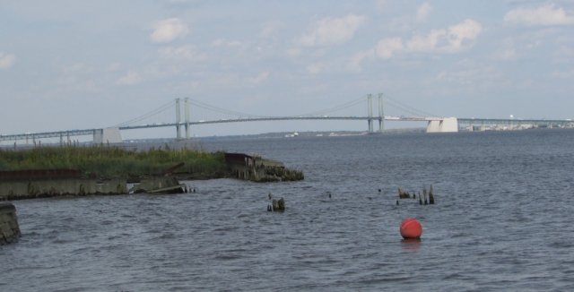
This container ship happened by while we were at the river.

We’re going to wrap up here, but in closing we will leave you with a photo of the Delaware Legislative Hall which is the state capitol building.

Thank you for joining us on the road. We hope that you will keep coming back for more great road trips and perhaps a tip or two. Until then…

Travel safe, travel smart, and we will see you down the road!

Mike and Kellye

IMG_0254

As always, we strive to be as accurate with our information as possible. If we made a mistake, it was unintentional. (Hey, we’re only human!) We aren’t paid for our recommendations, and we only recommend our own tried and true vendors and venues. Our suggestions are for places that we’ve heard good things about but haven’t visited personally, and our opinions are our own.

©2022

Featured

Chesapeake and Ohio Canal National Historical Park

The C & O Canal runs for 184.5 miles from Washington, DC to Cumberland, MD

The first idea for a canal was introduced as a bill submitted in 1774 to the Virginia governing body of the time by George Washington. His plan was to use the Potomac River as a means to move cargo, however, there were parts of the river that would be too dangerous for boats. He proposed to build a canal system that would enable navigation around those treacherous areas. After the Revolutionary War, his plans were set in motion and the Potowmack Canal Company was established with Washington at its helm. The canal was completed in 1802, three years after Washington’s death. It operated until 1828 when the Chesapeake and Ohio Canal Company took over Potowmack Canal Company and devised a plan to build a better canal system which would connect the Ohio River to the Chesapeake Bay. Under the new C & O plan, the canal would run next to the Potomac, but boats would not have to navigate the river. The construction period ran from 1828 to 1850, but the canal never made it to the Ohio River, mainly because the Baltimore and Ohio Railroad got there first. Moving cargo via the railroad was faster and more efficient. The canal was utilized from 1831 to 1924, and in its last years was used primarily for moving coal from the Allegheny Mountains to Washington, DC.

In 1938, the government purchased the canal with plans to turn it into a recreational area. President Eisenhower declared a portion of the canal a national monument in 1961. Ten years later, President Nixon signed a bill into law creating the Chesapeake and Ohio Canal National Historic Park.

Cushwa’s historic warehouse in Williamsport, MD, one of the three current visitor centers for the park

We chose to visit the Williamsport, MD portion of the park because it was the closest to our next destination. Our initial plans did not include this stop, but we are so glad we were able make the last minute change. Williamsport is the future home of the park’s headquarters. The National Park Service is currently refurbishing the site of a former lumber company that sits across the street from Cushwa’s.


This portion of the park sits at the confluence of the Potomac River (background) and Conococheague Creek (foreground). What a serene and beautiful place we found this to be on a lazy September morning. By the way, those trees on in the background are in West Virginia. Here the Potomac forms the border between West Virginia and Maryland.
The canal as it flows over the recently restored (in 2019) Conococheague Aqueduct
The 1879 Bollman bridge over the canal is one of the oldest standing iron railroad bridges in the US. Here you can see the towpath where mules would walk as they towed boats up and down the canal. Now, the towpath is used for a walking and biking trail. Trivia: the C & O Canal towpath at Harper’s Ferry, WV is part of the Appalachian Trail.

Wendell Bollman, a self-taught engineer who began his career at the age of 15, designed a specific type of truss, now called the Bollman Truss, that was used for many bridges built by the Baltimore and Ohio Railroad (B & O) including the one shown above. Trivia: the B & O Railroad is the same one that sits between Illinois and Atlantic Avenues as depicted on the classic Monopoly game board.

Built in 1923, this strange-looking contraption is the only one of it’s kind on the C & O Canal. It is a railroad lift bridge that operated like an elevator to lower the tracks enabling trains loaded with coal to cross the canal. It is now a pedestrian bridge.
A view of the railroad lift bridge from underneath
A different view of the Bollman bridge with railroad tracks on the ground next to the canal. These tracks (along with the railroad lift bridge seen in the previous photos) would have been for the trains delivering coal to the power plant, part of which can be seen in the top right-hand corner of the picture.

For more information about this historic park, click here: https://www.nps.gov/choh/index.htm

We are going to end our trip to the Chesapeake and Ohio Canal National Historical Park here, but we will leave you with one more look at the canal and towpath. Imagine warm sunshine, no breeze, the smells of the earth, and complete solitude with nothing to disturb you except the summery drone of an occasional cicada. This is that place.

Thank you so much for stopping by our blog! Please come back soon for another road trip, quick stop, or travel tip. We love hearing from our readers, so feel free to leave a comment, and be sure to “like” us, too. Become a follower so you never miss one of our posts. We will not share or sell your information

Until next time…

Travel safe, travel smart, and we will see you down the road!

Mike and Kellye

As always, we strive to be as accurate with our information as possible. If we made a mistake, it was unintentional. (Hey, we’re only human!) We aren’t paid for our recommendations, and we only recommend our own tried and true vendors and venues. Our suggestions are for places that we’ve heard good things about but haven’t visited personally, and our opinions are our own.

©2021


Featured

Monticello

The home of Thomas Jefferson, Monticello sits atop a hill on some of the 5,000 acres of land that he inherited from his father. Begun in 1768, it took Jefferson forty years to complete the house. This was partially due to his love of architecture and partially due to the fact that family members moved in and needed space. Our tour guide told us that Mr. Jefferson’s sister moved in with her eleven children during the years in which he was supposed to be enjoying retirement.

Thomas Jefferson’s bed is tucked into an alcove between the actual bedroom and his office.

About 60 percent of the current contents of the home did belong to Jefferson, though some items have been lost, are in other museums, or in the hands of private collectors. We saw several of his inventions, including a two-sided clock that can be seen inside the house and above the door on the porch, a dumbwaiter hidden in the side of the dining room fireplace that goes to the wine cellar, and a contraption which held a second pen and copied everything as he wrote.

The property, along with the University of Virginia, is a UNESCO World Heritage Site. The university, which is just a few miles from Monticello, was established by Jefferson who also designed the original buildings. Construction began on the most famous building, The Rotunda, in 1822, and was completed just after Jefferson’s death in 1826.

Sundial and view from the north terrace
Another view from the north terrace: The Rotunda at the University of Virginia. Jefferson wanted to be able to see the university from his home. Now it is visible through a hole in the trees.
The Rotunda, which was designed to be a library, at the University of Virginia up close with the symbols of the ultra secretive Seven Society and a statue of Thomas Jefferson
The Rotunda from the lawn. The Palladian architecture looks very similar to Monticello, but was modeled after the Pantheon in Rome.

Monticello was also home to more than 100 enslaved laborers, including Jefferson’s half sister-in-law, Sally Hemings. It is now known that Jefferson fathered at least six of Hemings children, four of whom lived to adulthood. The story of Sally Hemings is fascinating, though little is known about her – not even what she looked like or where she is buried. What is known about her is detailed on the Monticello website here: https://www.monticello.org/sallyhemings/. There are also Amazon Video and Netflix documentaries about her and her ancestors for those who want to learn more. Notably, James Hemings, Sally’s older brother, was Jefferson’s chef at Monticello. James went to Paris with Jefferson while he was serving as Minister to France. James was trained in French cooking there and became a master chef. Sally arrived in Paris two years later while serving as Jefferson’s daughter’s companion and maid. Interestingly, slavery had been outlawed by then in France so legally James and Sally were free while they lived there.

Another view of the house looking south

Mulberry Row, a community in itself, is where the laborers lived and worked at Monticello. Here the excavated remains of homes and several shops, such as ones where carpentry and blacksmithing among other crafts and trades took place, can be seen today. The lush flower and vegetable gardens that were once tended by enslaved people are still grown at Monticello along Mulberry Row. For more information on Mulberry Row click here: https://www.monticello.org/slavery/landscape-of-slavery-mulberry-row-at-monticello/.

Jefferson was penniless when he died on July 4, 1826. His heirs were tasked with selling off acreage, possessions (sadly this included slaves who were said to have represented 90 percent of his property) and eventually the grand house to pay the debts. Monticello passed through several owners before being purchased by the Thomas Jefferson Foundation in 1923.

Past Mulberry Row is a path that leads to Monticello’s cemetery where Thomas and Martha Jefferson are buried along with many members of their family. Though no known African-Americans are buried in the family cemetery at Monticello, archaeologists discovered an unmarked Jefferson-era slave cemetery in 2001. This discovery was important because it is known that 400 – 600 enslaved people worked and lived at Monticello, and until the cemetery was found nobody knew where they had been buried.

Thomas Jefferson’s grave

We could go on for days about what we learned at Monticello, however, we have to end somewhere. In closing, we leave you with these final tidbits:

*Monticello had up to five bathrooms (privies), or air closets as Jefferson referred to them on his blueprints for the home. Historians know that the house did not have flush toilets, but not much else is known about the workings of them.

*Though Jefferson was representing the government as the Minister to France, all expenses involved with living and entertaining there were out of his own pocket.

*The Hemings family were inherited by Thomas and Martha Jefferson upon the death of Mrs. Jefferson’s (and Sally Hemings’) father, John Wayles.

*Sally Hemings quarters were discovered and excavated in 2017 then restored and opened to the public in 2018.

*Jefferson was only thirty-three-years-old when he was asked to write the Declaration of Independence. It only took seventeen days for him to compose the document and two days for the Second Continental Congress to make changes and declare independence on July 4, 1776. We never knew that any government got things done that quickly!

Finally, we highly recommend clicking on https://www.monticello.org/ to learn about the third President of the United States and his beloved home.

Thank you for hanging with us through this long post. We hope you will join us again soon for another great road trip. Until next time…

Travel safe, travel smart, and we will see you down the road!

Mike and Kellye

IMG_5646

As always, we strive to be as accurate with our information as possible. If we made a mistake, it was unintentional. (Hey, we’re only human!) We aren’t paid for our recommendations, and we only recommend our own tried and true vendors and venues. Our suggestions are for places that we’ve heard good things about but haven’t visited personally, and our opinions are our own.

©2021