Featured

Cahokia Mounds

Where is Cahokia Mounds?

Cahokia Mounds State Historic Site is located at 30 Ramey Street in Collinsville, Illinois. The grounds are open to the public daily from sunrise to sunset. The site features:

  • Interpretive Center, museum, and gift shop
  • Hiking trails
  • Guided tours – reservations required
  • Self-guided tours of the site

Cahokia Mounds is a UNESCO World Heritage Site, a National Historic Landmark, and is on the National Register of Historic Places. Here is a link to the website: Cahokia

This view of the grounds shows some of the smaller mounds which may have been used for individual residences.

Why is Cahokia Important?

Dating to 1000 AD, Cahokia Mounds is the largest prehistoric Indian site north of Mexico. The site encompasses 2,200 acres of what once was an even larger ancient settlement occupied by a culture of people who were farmers, hunters, and traders. At one time mound complexes reached as far as current day St. Louis, Missouri. Today’s site contains 120 mounds. The Mississippians who built the mounds did so by digging earth from “borrow pits” and hauling it in baskets on their backs or by hand. Cahokia’s mounds contain an estimated 50 million cubic feet of borrowed earth. As the mounds grew, so did the community, and Cahokia became a center of Mississippian life and culture.

Mound view at Cahokia. This may be one of the twin mounds shown at the bottom of the grand plaza in the image below.

Cahokia’s Mounds and Buildings

Most of the mounds at Cahokia are rectangular pyramid shapes with flat tops although there are some round mounds that were used for burials. The people buried in the round mounds were probably chiefs or others of great importance to the community. Cahokians were usually buried in cemeteries. The exception to that point may be Mound 72, which is covered later in the post.

This artist’s rendition shows what Cahokia might have looked like at its peak.

Buildings at Cahokia were constructed of poles and thatch though some were also overlaid with a combination of clay and grass. Archaeological excavations have uncovered lodges, grain storages, and communal buildings. Evidence also shows that residences usually housed one family. The tops of the largest mounds were reserved for ceremonial structures or the homes of rulers.

Another site image showing what the buildings may have looked like as Cahokia grew.

Interestingly, professional anthropological studies and archaeological excavations did not begin at Cahokia until the 1960s. So in the grand scheme of things, what is known about the site is relatively new. Studies continue today, so there is a near constant stream of up-to-date information and theories. Undoubtedly, the examination of Cahokia will go on indefinitely.

Monks Mound

Monks Mound is the largest prehistoric earthwork in the Americas. Its name comes from the French Trappist monks who lived nearby and farmed the terraces of the mound in the early 1800s. The Cahokian chief, Great Sun is said to have ruled from the top of Monks Mound, therefore, Cahokia is sometimes referred to as City of the Sun.

Monks Mound

While construction of Monks Mound began around 950 AD, workers continued to enlarge it over the next 300 years. The building on the top terrace measured 48 feet by 104 feet and some believe it reached 50 feet high.

Monks Mound:

  • has a base that covers 14 acres
  • is 100 feet tall
  • contains 22 million cubic feet of earth
View of Monks Mound from the second terrace looking toward the stairs that lead to the top. In all, 156 steps lead from ground level to the top.
The “Birdman” is now the historic site’s logo.

Monks Mound once had four terraces. The artist’s rendering below shows how it may have looked at Cahokia’s peak.

Cahokia’s Stockade

The stockade was a two-mile long barrier, most likely used for defense. However, some theorists believe that it may have served as a barrier to separate the elite from the other residents of Cahokia. The portion we see today is obviously a replica, though the Stockade Trial follows the boundary line of where the eastern part of the original stockade stood.

Cahokia’s stockade probably looked similar to this but on a much larger scale.

Mound 72

While Monks Mound is the grandest because of its size, Mound 72 is probably the most anthropologically interesting of all of Cahokia’s mounds. In 1967 excavations of Mound 72 revealed 270 ceremonial burials. The majority of the bodies were discovered in mass graves and were determined to be young women who died sacrificially.

Cahokia’s Mound 72 was reconstructed after extensive excavations.

Excavations of Mound 72 also revealed two bodies, probably great leaders, atop a cache of 20,000 marine shell disc beads formed in the shape of a large falcon. Six additional bodies, which anthropologists determined were elite men, were found with a large number of burial offerings. Offerings included arrowheads, jewelry, and other artifacts, some of which came from as far away as the areas that are now the states of Tennessee and Oklahoma. Further excavations revealed the bodies of 39 people that, unlike the others, had met a violent end. Anthropologists studied their teeth and determined that those 39 unfortunate souls were probably immigrants or enemies of the Cahokians and not locals.

Cahokia’s Woodhenge

Woodhenge is a solar calendar that the ancient Cahokians used to determine the equinoxes and solstices for agricultural purposes and ceremonial dates.

Reconstruction of Cahokia’s Woodhenge

Excerpts from the site’s information board:

“At least five large post-circle monuments were built at this location from AD 1100 to 1200, each with a different diameter and number of posts. Woodhenge III is the circle most extensively excavated and is the one reconstructed here, in the original location.” “The most important alignments are the winter and summer solstices, marking the southernmost and northernmost sunrise positions, and the fall and spring equinoxes, when the sun rises due east, midway between the solstice posts. Also, at the equinoxes the sun appears to emerge from the front of Monks Mound, perhaps confirming a link between the sun and the chief who ruled from the top of the mound.”

Chief Great Sun atop Monks Mound at sunrise

Cahokia’s Demise

Scientific evidence finds that Cahokia’s inhabitants had begun their departure by 1250; however, the city had been completely abandoned by 1350 – 1400. The once thriving City of the Sun had been home to an estimated 20,000 people at its peak. No one really knows what happened to the Cahokians, but one theory suggests that flooding led to the demise of the great city. Another theory suggests that drought caused the residents to move elsewhere to grow their crops. Still others believe that disease or a 13th century earthquake may have been factors. Most likely, we will never know the reason, but the ancients did leave us with their legacy, one that piques our curiosity and inspires our desire to know more.

Trail and small mound

Our visit to Cahokia Mounds State Historic Site was great, but it would have been even better if we had been able to visit the Interpretive Center to learn more about the site. Unfortunately, the center which houses the museum is closed for renovations until the spring of 2023. Therefore, in our quest to “pass along the knowledge”, we have included a link to the introductive video from the interpretive center here.

Thanks so much for joining us on our tour of Cahokia Mounds!

We have more Native American history! Check out these interesting sites:

Pecos National Historical Park
Washita Battlefield National Historic Site
San Antonio Missions

Travel safely, and we will see you on the road.

  Mike and Kellye

As always, we strive to be as accurate with our information as possible. If we made a mistake, it was unintentional. (Hey, we’re only human!) Our suggestions are for places that we’ve heard good things about but haven’t visited personally, and our opinions are our own.

©2022                  

Featured

Ruidoso Road Trip: Things to Do

IMG_4815
Sierra Blanca Peak, Ruidoso, New Mexico

Looking for a road trip adventure with things to do for the whole family? Ruidoso, New Mexico is a great bet! Tucked snugly beneath towering mountain peaks and fragrant whispering pines, the quaint alpine village is a perfect getaway destination. We started going there as kids with our parents and grandparents, and we’ve been going back ever since!

Fall aspens near Ruidoso

The area offers skiing and other snow sports in the winter, along with the smoky-sweet aroma of pinion pine woodfires. Summer brings the thrill of horse racing as well as outdoor adventures such as hiking, fishing, horseback riding and golfing. While visiting Ruidoso, be on the lookout for the band of beautiful wild horses that roam around town. We love Ruidoso any time of year, but if we had to choose our favorite month to visit, we would choose October. We’re anxious to share this road trip with you, so let’s get going!

Ruidoso is approximately:

140 miles from El Paso, Texas180 miles from Albuquerque, NM250 miles from Lubbock, Texas

This airport to destination road trip is going to start in El Paso since it is the closest city with a major airport. Drive time between El Paso and Ruidoso: 2.5 hours.

City view of El Paso, Texas

Things to do in El Paso:

  • Chamizal National Memorial
  • Franklin Mountains State Park
  • Hueco Tanks State Park and Historic Site
  • Museum of History
  • Zoo and Botanical Gardens
  • Museum of Art
  • Mission Trail
  • Water Parks
  • Children’s Museum

Getting There

IMG_4651

From El Paso, take US Highway 54 north toward Tularosa via Alamogordo, then take US Highway 70 northeast to Ruidoso.

⇒Alternate (recommended) Route: from El Paso, take I-10 north to Las Cruces, New Mexico. Drive time between El Paso and Las Cruces: 49 minutes

Bonus stop: Las Cruces

Stop for an hour or two to visit Old Mesilla Village. Walk the plaza which is a National Historic Landmark. Mesilla offers shopping venues as well as dining with a serving of history on the side. If a hike sounds appealing, check out the Dripping Springs Natural Area at Organ Mountains-Desert Peaks National Monument for scenic trials. While in Las Cruces, look for the mural-painted water tanks and the giant roadrunner sculpture made from an array of recycled junk such as old sneakers and computer components.

Organ Mountains near Las Cruces – photo by Jason Pofahl

From Las Cruces take US Highway 70 north to White Sands National Park. Drive time between Las Cruces and White Sands: 52 minutes.

Bonus stop: White Sands National Park

Currently $25.00 per vehicle to enter the park. The gift shop at the visitor center sells sand discs for sledding on the dunes. Even if sledding isn’t your thing, the scenery is out of this world. There are plenty of places to park along Dunes Drive, so get out of the car and climb the gypsum dunes for spectacular views and photo ops with the mountains as the backdrop. Here’s the link: White Sands National Park

Travel tip: before you go, check the website for temporary park and highway closures due to testing at White Sands Missile Range. Closures typically last three hours or less.

IMG_4745
White Sands National Park

From White Sands, take US Highway 70 to Alamogordo. Drive time between White Sands and Alamogordo: 17 minutes

Bonus stop:  Alamogordo

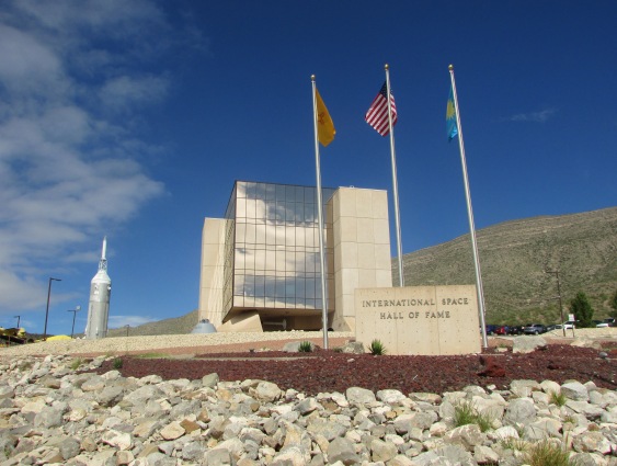
Plan to spend a couple of hours at the New Mexico Museum of Space History/International Space Hall of Fame, as it is a fantastic museum that both kids and adults will love. Alamogordo offers many hotel and restaurant choices, as well as a state park, wineries, and a zoo. While you’re in town, be on the lookout for the world’s largest pistachio! 

IMG_4772
International Space Hall of Fame, Alamogordo, New Mexico

From Alamogordo, take US Highway 54 north to Tularosa (13 miles), then take US Highway 70 northeast to Ruidoso. Drive time between Alamogordo and Ruidoso: 1 hour

⇒Alternate (recommended) Route: from Alamogordo, take US Highway 82 east to Cloudcroft. (19 miles of steep two-lane road.) This route through the Lincoln National Forest is very scenic. Drive time between Alamogordo and Ruidoso via this route: 1.5 hours without stops

Travel tip: when approaching the “Tunnel Ahead” sign, slow down for a pull out. The view of White Sands from the viewpoint is pictured below.

IMG_4781

Continue east on US Highway 82. Right before you reach the village of Cloudcroft, there is another pull out. Stop and get out of the car, stretch your legs, and breathe in the fresh mountain air. (The elevation is about 8650 feet.) Learn about the historic Cloudcroft Railroad/Mexican Canyon Trestle pictured below. This only remaining portion of the old rail line is on the National Register of Historic Places.

IMG_4785

Bonus stop: Cloudcroft.

Stop and have a look around the village that is home to Ski Cloudcroft. The village also has shopping, restaurants, history, and a totally laid-back atmosphere. *Recommended restaurant in Cloudcroft: Dave’s Cafe – 300 Burro Ave. Good food and good service.

Bonus Road Trip: Sunspot Solar Observatory

Head south from Cloudcroft on Highway 130 toward Sunspot via the Sunspot Highway (aka Highway 6563). It is an extremely scenic drive (a total of 19 miles in the Lincoln National Forest) that ends at the observatory.  Along the road, be sure to stop at the scenic viewpoint pull out for fabulous views of White Sands and the Tularosa Basin. At the observatory, stop in at the visitor center then take a self-guided tour of the telescopes. The elevation at Sunspot is about 9200 feet.

Travel tip: Google Maps for directions to Sunspot are not reliable.

From Cloudcroft, take Highway 244 north to US Highway 70 to Ruidoso. Highway 244 is also a scenic route through the Lincoln National Forest. Drive time from Cloudcroft to Ruidoso: 1 hour.

Travel tip: watch for deer and elk along this road.

Did we mention why we like this area in October?

IMG_4809
Fall colors just outside of Ruidoso in Lincoln National Forest

Destination: Ruidoso, New Mexico

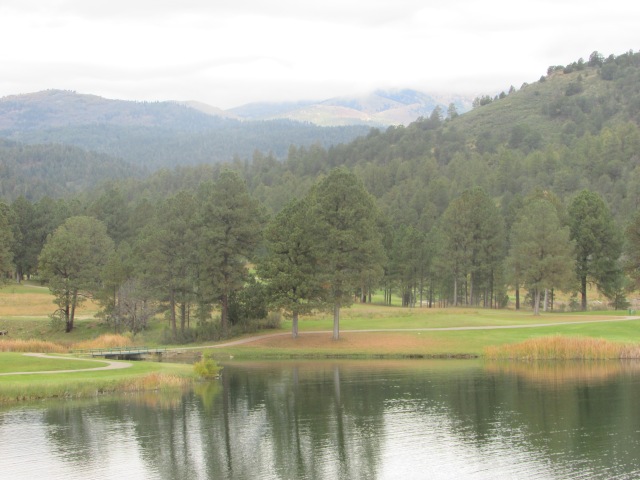
As for places to stay in Ruidoso, Inn of the Mountain Gods is our first choice. The resort has everything visitors want, including a gorgeous yet challenging golf course, restaurants, a casino, and an RV campground. Here’s a link: Inn of the Mountain Gods

IMG_4719

We also recommend:

  • Hampton Inn – preferred chain hotel in Ruidoso
  • Casa Blanca – preferred Mexican Food – 501 Mechem Dr.
  • Ranchers Steak and Seafood Restaurant – preferred splurge restaurant- 2823 Sudderth Dr. – make a reservation for dinner
  • Wendell’s Steak and Seafood at Inn of the Mountain Gods – preferred splurge restaurant – make a reservation for dinner
  • Anaheim Jacks – preferred lunch stop – 1097 Mechem Dr.

Things to do in Ruidoso:

  • Bet! Enjoy the excitement of summer horse racing at Ruidoso Downs. The adjoining Billy the Kid Casino is open year-round.
  • Gamble! Play the slots or try your hand at one the gaming tables at Inn of the Mountain Gods Casino.
  • Shop! Ruidoso’s walkable downtown offers a variety of great shops and art galleries. There is bound to be something for every heart’s desire.
  • Play! There are public golf courses, a public swimming pool, tennis courts, public parks, a bowling alley, miniature golf, bumper boats, go-carts, Wibit Water Park, and horseback riding stables, just to name a few.IMG_4710
  • Ski! Head to Ski Apache for wintertime fun in the snow. There is also a site for sledding and tubing near the ski area.
  • Learn! Check out the Hubbard Museum of the American West, located just east of Ruidoso Downs racetrack.
  •  Hike or Bike! There are many hiking and biking trails in the area. Here’s a link for trail information: Ruidoso Trails
  • Enjoy the Water! Area lakes provide the perfect setting for canoeing, kayaking, or fishing.
  • Drive the Billy the Kid National Scenic Byway. Stop in at the Billy the Kid National Scenic Byway Visitor Center in Ruidoso Downs (next to the Hubbard Museum of the American West) before traveling to the following sites. Here’s a link: Billy the Kid Scenic Byway.

Things to do on the Billy the Kid National Scenic Byway

First stop:

For nostalgia buffs, head northeast on Highway 48 from Ruidoso to Capitan for a visit to Smokey Bear Historical Park. Spend an hour touring the museum and nature area and see Smokey’s final resting place. Tickets are $2.00 per adult and $1.00 for kids between the ages of seven and twelve. Six and under are free. Cash only.

Second stop:

Head east on US Highway 380 to Fort Stanton Historic Site. Take a tour of the grounds and learn the importance of this historic fort. Allow 1-2 hours to visit the site. Here’s a link: Fort Stanton.

Third stop:

Lincoln, New Mexico is a great stop for some Old West history. (East on US Highway 380 from Fort Stanton.) Learn about the Lincoln County War, Sheriff Pat Garrett, and Billy the Kid, while touring the historic buildings in town. Tickets for entrance into the museum and designated buildings are $7.00 per adult at the visitor center. There is also a nice hiking/nature trail along the Rio Bonito. Allow 1-2 hours to visit Lincoln.

Old Lincoln County Courthouse

Fourth Stop: 

Head southeast on 380 from Lincoln to Hondo. At Hondo turn right on to US Highway 70 to San Patricio, home of artists Peter Hurd, Henriette Wyeth-Hurd, and Michael Hurd. The family’s ranch features guest homes, a winery and tasting room, and The Hurd la Rinconada Gallery. Open Tuesdays through Saturdays, 9:00 to 5:00 – 105 La Rinconada in San Patricio, New Mexico, 25 miles east of Ruidoso.

Sedona 2007 158

We’re going to end this post with one last road trip idea. See it all, do it all, right?

Just a one-hour drive east from Ruidoso is the city of Roswell, New Mexico. Remember the 1947 Roswell incident? Well, whether or not you believe a flying saucer crashed there, a trip to the International UFO Museum and Research Center might be a fun stop to add to your itinerary.

Hopefully we have inspired your wanderlust, and if a trip to New Mexico is on your radar, we sincerely hope that you will make plans to visit Ruidoso and surrounding areas in the future. Until the next trip…

Travel safe, travel smart, and we will see you down the road.

Mike and Kellye

IMG_2120

(This is an updated and enhanced version of a prior post published on October 27, 2018.)

Need more inspiration? Click the links to view these other great road trip destinations:

Amarillo, Texas

Albuquerque to Taos Road Trip: Things to Do

Palo Duro Canyon State Park

As always, we strive to be as accurate with our information as possible. If we made a mistake, it was unintentional. (Hey, we’re only human!) We aren’t paid for our recommendations, and we only recommend our own tried and true vendors and venues. Our suggestions are for places that we’ve heard good things about but haven’t visited personally, and our opinions are our own.

©2022

Featured

Wish We Were There Wednesday: Random Places

Today we’re taking a random places road trip, and we are so happy to have you along for the ride. Enjoy!

Pike Place Market, Seattle. Established in 1907, it is the oldest running farmer’s market in the U.S. The original Starbucks opened here in 1971.

The Green Monster left field wall at Fenway Park, Boston. The reason the wall is there? To keep people from watching the game for free. In 2003, 269 barstool seats and 100 standing room only spaces were added to the deck on the wall, however tickets for those seats are hard to come by. By the way, the scoreboard on the Green Monster is still updated by hand. Fenway Park has been the home of the Boston Red Sox since 1912.

Smokey Bear’s gravesite, Capitan, New Mexico. The idea of a fire prevention mascot was conceived in 1944 when the National Forest Service came up with a character called Smokey Bear. In 1950, a black bear cub was found badly burned after a forest fire in the Capitan Mountains of the Lincoln National Forest. The firefighters who found him named him Smokey. A popular living symbol of fire prevention, Smokey made his home at the National Zoo in Washington, D.C. until he died in 1976. He was returned to Capitan where he was buried in what is now Smokey Bear Historical Park.

Ernest Tubb Record Shop, Nashville. Home of the Midnite Jamboree, which started right after the Grand Ole Opry show was over on Saturday nights. Ernest helped many artists get their start right there in that store until 1974 when the show was moved to another venue. The Midnite Jamboree was moved back to the store in 2021. Tubb was born in Texas, 35 miles south of Dallas. He performed and wrote songs up until his health required him to quit in 1982. He died in 1984. In March 2022, it was announced that the store is being sold and the Midnite Jamboree would be ending.

Geographic Center of the U.S. The actual survey marker is 22 miles north of town, but Belle Fourche, South Dakota does a great job of letting people know it’s close by.

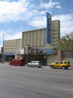
UFO Museum and Research Center, Roswell, New Mexico. Occupying a 1930s era movie theater, the museum was opened in 1991. In addition to the exhibits, mostly about the so-called Roswell incident, they also have a gift shop that carries things like bumper stickers that say, “I Like Aliens, They Taste Just Like Chicken”, and other gotta-take-one-of-these-home souvenirs.

Granary Burying Ground, Boston. Established in 1660, Paul Revere, Samuel Adams, and John Hancock are all buried here, along with some of Ben Franklin’s family members and victims of the Boston Massacre, among others. It is estimated that more than 5,000 people are buried in this small cemetery, though there are just over 2,300 markers.

Buffalo Bill Ranch State Historical Park, Nebraska. Site of Buffalo Bill Cody’s Scout’s Rest Ranch, which was his home from 1886 to 1913. This beautiful barn was built in 1887 to house his purebred stallions and other livestock that lived on the 4,000-acre ranch. His mansion is shown below.

Buffalo Bill Cody’s home at Scout’s Rest Ranch

Reflections on the Colorado River, Moab, Utah. Did you know that the Colorado River Basin is part of eleven national parks? The Colorado River also flows through seven states, two Mexican states, and it forms a partial border between Arizona and Mexico.

Provincetown, Massachusetts. Fleeing religious persecution in England, the Pilgrims on the Mayflower landed first at Provincetown in 1620 where the men on the ship signed the Mayflower Compact. The compact was a document whereby they agreed to self-rule the colony they were set to establish in the New World. After finding no fresh water in the area, they sailed across the bay to Plymouth, and the rest, they say, is history.

The Stanley Hotel, Estes Park, Colorado. Freelan O. Stanley, inventor of the Stanley Steamer automobile, opened the hotel in 1909. In the 1970s Stephen King visited the hotel and was inspired to write his novel The Shining. Today, the Stanley Hotel claims to be one of the most haunted hotels in the country with none other than Freelan and his wife, Flora (among other spirits) roaming the hallways. We toured this stunning hotel, and even went in the basement, but we didn’t see any paranormal activity – or Jack Nicholson!

That’s going to do it for today. Thanks so much for joining us on our random places road trip. We hope you will return to our site again for more sights, scenery, trips, tricks, and tips. Be sure to sign up to be an e-mail follower so you never miss a post, and follow us on Facebook, Pinterest, and Twitter. Tell your friends! We want to be friends with them, too.

Happy hump day, everybody!

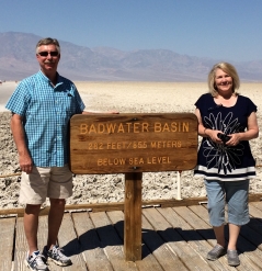
Badwater Basin

As always, we strive to be as accurate with our information as possible. If we made a mistake, it was unintentional. (Hey, we’re only human!) We aren’t paid for our recommendations, and we only recommend our own tried and true vendors and venues. Our suggestions are for places that we’ve heard good things about but haven’t visited personally, and our opinions are our own.

©2022